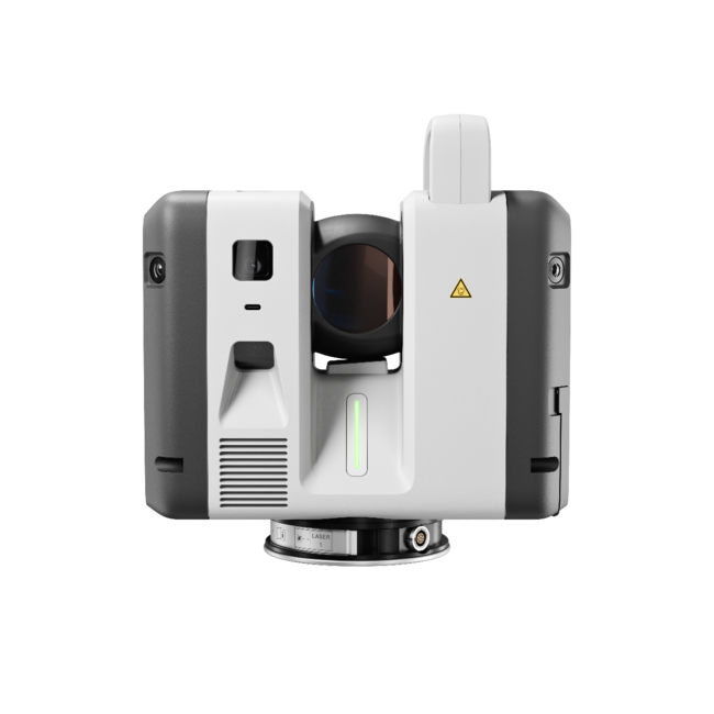
DESIGN & PHYSICAL
Housing
Aluminium frame and sidecovers
Width: 240 mm (9.45 in.)
Height: 230 mm (9.06 in.)
Depth: 120 mm (4.72 in.)
Weight
5.35 kg
6.03 kg with battery
Mounting
Quick mounting on 5/8 in. stub on lightweight tripod / optional tribrach adapter / survey tribrach adapter available
OPERATION
On Scanner
Touch-screen control with finger touch, full colour WVGA graphic display 480 x 800 pixels
Control
Leica Cyclone FIELD 360 app for iPad or Android tablets including: Remote control of scan functions, 2D & 3D data viewing, Tagging, Automatic alignment of scans
Wireless
Integrated wireless LAN (802.11 b/g/n)
Data Storage
Leica MS256, 256GB exchangeable USB 3.0 flash drive
POWER
Internal
2 x Leica GEB361 internal, rechargeable Li-Ion batteries. Duration: Typically up to 4 hours Weight: 340 g per battery
External
Leica GEV282 AC adapter
SCANNING
Distance Measurement
High-speed, high dynamic time of flight enhanced by Waveform Digitizing (WFD) technology, 1550 nm (invisible) wavelength
Laser Class
1 (in accordance with IEC 60825-1:2014)
Field of View
360 ° (HORIZONTAL)
300 ° (VERTICAL)
Range
0.5 m (MIN)
130 m (MAX)
Speed
Up to 2,000,000 pts/sec
Density
3 user selectable settings (3/6/12mm @ 10m)
IMAGING
Camera
36 MP 3-camera system captures 432 MPx raw data for calibrated 360° x 300° spherical image
Speed
1 minute for full spherical HDR image at any light condition
HDR
Automatic, 5 brackets
ENVIRONMENTAL
Operating Temperature
-10 ° C (MIN)
40 ° C (MAX)
Storage Temperature
-40 ° C (MIN )
70 ° C (MAX)
IP Rating
Solid particle/liquid ingress protection IP54 (IEC 60529)
NAVIGATION SENSORS
Visual Inertial System
Video enhanced inertial measuring system to track movement of the scanner position relative to the previous setup in real time
Tilt
IMU based, Accuracy: 18 in. (for upright and upside down setups with +/- 5° inclination)
Altimeter
Yes
Compass
Yess
GNSS
Yes
ACCURACY
Angular
18"
Range
1.0 mm + 10 ppm
3D Point Accuracy
1.9 mm @ 10 m
2.9 mm @ 20 m
6.5 mm @ 50 m
DATA PROCESSING
Data Transfer
USB, Ethernet, Wireless
Desktop Software
Leica Cyclone REGISTER 360 PLUS (all versions)

RH Borden
Lehi, Utah
“R-E-A-L.iT’s assistance in helping RH Borden to get the most out of reality capture technology for our business has helped us deliver exceptional results for our clients. The custom software script that R-E-A-L.iT’s team created for us is enabling us to get high-quality deliverables into the hands of our clients in record time.”
Jon Borden
CEO / RH Borden
Point3D
Ottawa, Ontario
“R-E-A-L.iT has been our dedicated source for all Leica Geosystems products for some time and we couldn’t be happier than with the service we’ve received. Their team shows passionate product knowledge and a handle on the latest in the latest industry. Derek has always been quick, courteous and very helpful. We will continue to purchase and rent Leica Geosystems 3D laser scanners with R-E-A-L.iT.”
Spencer MacPherson
CEO / Point3D
Slate Architecture
Helena, Montana
“We’ve really enjoyed working with R-E-A-L.iT — renting reality capture gear through your team has been a smooth, reliable experience that helps us stay agile and efficient on our projects. The equipment is top-notch, and your service makes it easy to focus on the work at hand.”
Warren Curry
Architect / Slate Architecture
TELUS Communications
Calgary, Alberta
“Unlike with some sales experiences, Derek and his team have been constantly available to us both pre- and post-sale, partnering with TELUS in implementing complex and long-term applications of reality capture solutions to our business.”
Patrick Provost
Technical Field Representative / TELUS Communications