ENGINEERING

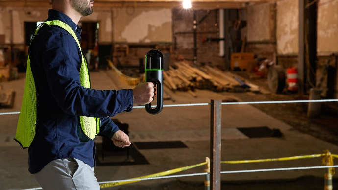
Streamline your engineering workflow by capturing millimetre accurate models of any as built structure.

Learn More

Customers we've served

Countless general contractors have already used our solutions to enhance their workflows. 


EllisDon Construction
Canada

Bird Construction
Canada

Pomerleau Inc.
Canada

PCL Construction
Canada

Kenaidan Construction
Canada

Canatal Industries
Canada

Capture your world, faster than ever.


Engineering projects depend on accurate data to support design, analysis, and long-term infrastructure planning. Reality capture technologies such as 3D laser scanning allow engineers to quickly collect precise measurements of existing conditions, providing a reliable foundation for engineering calculations and project development.

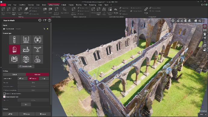
By capturing millions of data points in a short amount of time, engineering teams can create detailed digital models of structures and infrastructure, improving design accuracy and reducing the need for repeated field visits. This fast and reliable data collection helps engineers make informed decisions earlier in the project lifecycle while minimizing risk and uncertainty.

Increase Your Efficiency


Engineering workflows often involve complex site documentation, measurements, and coordination between multiple disciplines. Reality capture streamlines these processes by providing accurate, comprehensive data that can be shared instantly across teams.

With reliable digital documentation available from the start, engineers can reduce manual surveying time, accelerate design development, and improve coordination between project stakeholders. Studies have shown that modern reality capture technologies can significantly reduce fieldwork time while improving data quality, allowing engineering teams to focus on solving problems rather than collecting measurements.

Monitor and Maintain with Accuracy and Ease


Infrastructure assets such as bridges, roads, tunnels, and industrial facilities require continuous monitoring to ensure safety and performance. Reality capture enables engineers to create highly detailed digital records of these assets, making it easier to track structural changes and plan maintenance activities.

By capturing accurate baseline data and comparing future scans over time, engineers can detect deformation, settlement, or wear before it becomes a critical issue. This proactive monitoring approach supports better asset management, reduces maintenance costs, and helps extend the lifespan of infrastructure systems. 

Safety First. Always.


Engineering projects often involve hazardous environments, including elevated structures, confined spaces, and active construction zones. Reality capture technologies help reduce risk by allowing engineers to collect data remotely without exposing personnel to unnecessary danger.

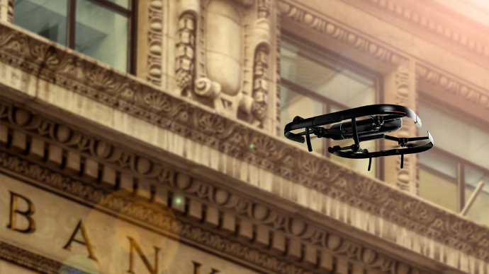
Using laser scanning, drones, and mobile mapping systems, teams can inspect infrastructure safely from a distance while maintaining full visibility of site conditions. This approach improves worker safety, supports compliance with safety regulations, and reduces downtime caused by restricted site access or hazardous conditions.

Better Visualizations


Engineering decisions are often complex and require clear communication between designers, project managers, and stakeholders. Reality capture provides highly detailed 3D models and visualizations that make it easier to understand project conditions and evaluate design options.

These visualizations allow engineers to present technical information in a clear and accessible format, helping stakeholders review designs, identify potential issues, and approve project plans with confidence. Improved visualization leads to better collaboration, faster approvals, and more efficient project delivery across engineering teams.


Better Monitoring and Maintenance


Engineering assets must be managed throughout their entire lifecycle, from initial construction to long-term operation and maintenance. Reality capture provides accurate digital records that support predictive maintenance and condition monitoring strategies.

By regularly capturing and analyzing infrastructure data, engineers can identify performance trends, prioritize repairs, and optimize maintenance schedules based on real-world conditions. This data-driven approach improves reliability, reduces unexpected failures, and ensures infrastructure systems remain safe and operational over time.

Scanners perfect for engineering

See some of our product line that are tailored for engineers below.

Your Dynamic Snippet will be displayed here... This message is displayed because you did not provided both a filter and a template to use.

What Our Clients Say

Trusted by companies across Canada and the United States.

RH Borden
Lehi, Utah

“R-E-A-L.iT’s assistance in helping RH Borden to get the most out of reality capture technology for our business has helped us deliver exceptional results for our clients. The custom software script that R-E-A-L.iT’s team created for us is enabling us to get high-quality deliverables into the hands of our clients in record time.”

Jon Borden CEO / RH Borden
Point3D
Ottawa, Ontario

“R-E-A-L.iT has been our dedicated source for all Leica Geosystems products for some time and we couldn’t be happier than with the service we’ve received. Their team shows passionate product knowledge and a handle on the latest in the latest industry. Derek has always been quick, courteous and very helpful. We will continue to purchase and rent Leica Geosystems 3D laser scanners with R-E-A-L.iT.”

Spencer MacPherson CEO / Point3D
Slate Architecture
Helena, Montana

“We’ve really enjoyed working with R-E-A-L.iT — renting reality capture gear through your team has been a smooth, reliable experience that helps us stay agile and efficient on our projects. The equipment is top-notch, and your service makes it easy to focus on the work at hand.”

Warren Curry Architect / Slate Architecture
TELUS Communications
Calgary, Alberta

“Unlike with some sales experiences, Derek and his team have been constantly available to us both pre- and post-sale, partnering with TELUS in implementing complex and long-term applications of reality capture solutions to our business.”

Patrick Provost Technical Field Representative / TELUS Communications
RH Borden
Lehi, Utah

“R-E-A-L.iT’s assistance in helping RH Borden to get the most out of reality capture technology for our business has helped us deliver exceptional results for our clients. The custom software script that R-E-A-L.iT’s team created for us is enabling us to get high-quality deliverables into the hands of our clients in record time.”

Jon Borden CEO / RH Borden
Point3D
Ottawa, Ontario

“R-E-A-L.iT has been our dedicated source for all Leica Geosystems products for some time and we couldn’t be happier than with the service we’ve received. Their team shows passionate product knowledge and a handle on the latest in the latest industry. Derek has always been quick, courteous and very helpful. We will continue to purchase and rent Leica Geosystems 3D laser scanners with R-E-A-L.iT.”

Spencer MacPherson CEO / Point3D
Slate Architecture
Helena, Montana

“We’ve really enjoyed working with R-E-A-L.iT — renting reality capture gear through your team has been a smooth, reliable experience that helps us stay agile and efficient on our projects. The equipment is top-notch, and your service makes it easy to focus on the work at hand.”

Warren Curry Architect / Slate Architecture
TELUS Communications
Calgary, Alberta

“Unlike with some sales experiences, Derek and his team have been constantly available to us both pre- and post-sale, partnering with TELUS in implementing complex and long-term applications of reality capture solutions to our business.”

Patrick Provost Technical Field Representative / TELUS Communications

Ready to get started capturing your reality?

Contact us now for more information or to get started on your reality capture journey.