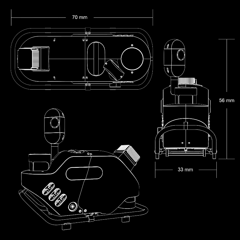
PEGASUS TRK
EFFICIENT REALITY CAPTURE EQUIPMENT
AUTONOMOUS : INTELLIGENT : SIMPLIFIED
Introducing The New Pegasus TRK range, including the Leica Pegasus TRK Neo 500 and 700, and the TRK Evo 500 and 700.
Meet the Tech.
Expand And Go. More Details. More Possibilities.
Fully integrated modular imaging system allows you to add more cameras, for more angles, more detail and more possibilities. Automatic camera calibration simplifies and streamlines system set up so you can expand and go. Collecting at up to 8 frames per second, no detail is missed.
Bring Images And Data To Life
SmartFusion camera system with up to 120MP integral view. Boosted with add-on front, side and rear pavement cameras, the Pegasus TRK is expandable with a click. The additional cameras multiply the resolution, creating the same level of detail as a 156MP spherical camera.
See High Or See Wide
The butterfly side cameras have a dual position, vertical and horizontal, enabling to capture vertical arches in high resolution for texturing and damage analysis or horizontal features like traffic signs or civic numbers.

SLAM All The Time
A sophisticated integration of IMU and SLAM (Simultaneous Localization and Mapping) technology enables georeferencing in GNSS denied areas such as tunnels or dense urban environments.
Apply your data.
Bring images and data to life.
Best-in-class colour truth - brought to life as it is in reality. Pegasus TRK features a SmartFusion ‘butterfly’ camera system with up to 120MP integral view. Boosted with add- on front, side and rear pavement cameras, TRK is expandable with a click. The additional cameras multiply the resolution, creating data-rich imagery. Enhanced calibration delivers true colour imagery according to the CIEDE2000 colour-difference formula.

Built-in Privacy
Say goodbye to manual object blurring. People and vehicles are anonymised in real-time, protecting citizen privacy and ensuring GPDR compliance. Integrated with a real-time AI algorithm, the Pegasus TRK solution actively identifies and blurs complete objects directly in the imagery as the data is collected. All information is encrypted and won’t leave your Pegasus TRK system.

Plan. Capture. Deliver
Plan and execute projects with confidence. Spontaneous visual and audio feedback along the route makes data collection failure a thing of the past. Leica Pegasus FIELD predicts the time required for planned missions and storage and battery capacity needed to perform the job. Throughout the journey, image previews, accuracy estimations, and live system feedback instil absolute confidence in the data acquisition process.

Specifications
DESIGN & PHYSICAL
Width: 33 cm (12.9 inches), Height: 56 cm (22 inches)
WEIGHT
18 kg 23 kgMOUNTING
Rotational-tilt mount, adjustable in horizontal postition -30°, 0°, +30°, tilitng up to 45° improving accesibility and ergonomics by reducing 36cm the mounting height.OPERATION
CONTROL
Pegasus FIELD - browser-based interface, accessible by Wi-FI or cable; Mission Planning, Project Management, autonomous data acquisition with routed navigation, real-time anonymisation, pre-processing and remote support.WIRELESS
Integrated WirelessDATA STORAGE
2x2TB or 2x3.8TB, real-time data stream to high performance, removable SSD'sPOWER
EXTERNAL
Hot-swappable, up to 3 x Li-Ion Pegasus battery units. 7h /battery unitSCANNING
LASER CLASS
Class 1, eye safeFIELD OF VIEW
360°C (HORIZONTAL), 360°C (VERTICAL)RANGE
1.5m (MIN), Maximum range 490m/250m (50% reflectivity), 205m/130m (10% reflectivity)m (MAX)SPEED
500,000 pts/secDENSITY
Based on capture speedIMAGING
CAMERA
120 Mpixel total (24 Mpixel panoramic camera, 48 Mpixel butterly side, 24 Mpixel pavement, 24 Mpixel front). Self-calibrating directional cameras. Real-time AI-driven image blurring (DDPR compliant, data encrypted). Real-time automatic brightness control.SPEED
By distance at 8 fpsENVIRONMENTAL
OPERATING TEMPERATURE
-10° (MIN), 50° (MAX)STORAGE TEMPERATURE
-20° C° (MIN ), 50° C° (MAX)IP RATING
IP67 during operation, fully dust tight and withstands temporary immersion under waterNAVIGATION SENSORS
GNSS
Leica AS11 GNSS antenna for faster initialisation by more accurate headingDESIGN & PHYSICAL
Width: 46 cm (18.1 inches), Height: 56 cm (22 inches)
WEIGHT
23 kg 28 kgMOUNTING
Rotational-tilt mount, adjustable in horizontal postition -30°, 0°, +30°, tilitng up to 45° improving accesibility and ergonomics by reducing 36cm the mounting height.OPERATION
CONTROL
Pegasus FIELD - browser-based interface, accessible by Wi-FI or cable; Mission Planning, Project Management, autonomous data acquisition with routed navigation, real-time anonymisation, pre-processing and remote support.WIRELESS
Integrated WirelessDATA STORAGE
2x2TB or 2x3.8TB, real-time data stream to high performance, removable SSD'sPOWER
EXTERNAL
Hot-swappable, up to 3 x Li-Ion Pegasus battery units. 6h/battery unitSCANNING
LASER CLASS
Class 1, eye safeFIELD OF VIEW
360°C (HORIZONTAL), 360°C (VERTICAL)RANGE
1.5m (MIN), Maximum range 490m/250m (50% reflectivity), 205m/130m (10% reflectivity)m (MAX)SPEED
1,000,000 pts/secDENSITY
Based on capture speedIMAGING
CAMERA
120 Mpixel total (24 Mpixel panoramic camera, 48 Mpixel butterly side, 24 Mpixel pavement, 24 Mpixel front). Self-calibrating directional cameras. Real-time AI-driven image blurring (DDPR compliant, data encrypted). Real-time automatic brightness control.SPEED
By distance at 8 fpsENVIRONMENTAL
OPERATING TEMPERATURE
-10° (MIN), 50° (MAX)STORAGE TEMPERATURE
-20° C° (MIN ), 50° C° (MAX)IP RATING
IP67 during operation, fully dust tight and withstands temporary immersion under waterNAVIGATION SENSORS
GNSS
Leica AS11 GNSS antenna for faster initialisation by more accurate headingDESIGN & PHYSICAL
Width: 33 cm (12.9 inches), Height: 56 cm (22 inches)
WEIGHT
21 kg 26 kgMOUNTING
Rotational-tilt mount, adjustable in horizontal postition -30°, 0°, +30°, tilitng up to 45° improving accesibility and ergonomics by reducing 36cm the mounting height.OPERATION
CONTROL
Pegasus FIELD - browser-based interface, accessible by Wi-FI or cable; Mission Planning, Project Management, autonomous data acquisition with routed navigation, real-time anonymisation, pre-processing and remote support.WIRELESS
Integrated WirelessDATA STORAGE
2x2TB or 2x3.8TB, real-time data stream to high performance, removable SSD'sPOWER
EXTERNAL
Hot-swappable, up to 3 x Li-Ion Pegasus battery units. 7h /battery unitSCANNING
LASER CLASS
Class 1, eye safeFIELD OF VIEW
360°C (HORIZONTAL), 360°C (VERTICAL)RANGE
0.3m (MIN), Maximum range 182m (10% reflectivity)m (MAX)SPEED
500,000 pts/secDENSITY
Based on capture speedIMAGING
CAMERA
120 Mpixel total (24 Mpixel panoramic camera, 48 Mpixel butterly side, 24 Mpixel pavement, 24 Mpixel front). Self-calibrating directional cameras. Real-time AI-driven image blurring (DDPR compliant, data encrypted). Real-time automatic brightness control.SPEED
By distance at 8 fpsENVIRONMENTAL
OPERATING TEMPERATURE
-10° (MIN), 50° (MAX)STORAGE TEMPERATURE
-20° C° (MIN ), 50° C° (MAX)IP RATING
IP65 | IP66 with protection capNAVIGATION SENSORS
GNSS
Leica AS11 GNSS antenna for faster initialisation by more accurate headingDESIGN & PHYSICAL
Width: 46 cm (18.1 inches), Height: 56 cm (22 inches)
WEIGHT
29 kg 34 kgMOUNTING
Rotational-tilt mount, adjustable in horizontal postition -30°, 0°, +30°, tilitng up to 45° improving accesibility and ergonomics by reducing 36cm the mounting height.OPERATION
CONTROL
Pegasus FIELD - browser-based interface, accessible by Wi-FI or cable; Mission Planning, Project Management, autonomous data acquisition with routed navigation, real-time anonymisation, pre-processing and remote support.WIRELESS
Integrated WirelessDATA STORAGE
2x2TB or 2x3.8TB, real-time data stream to high performance, removable SSD'sPOWER
EXTERNAL
Hot-swappable, up to 3 x Li-Ion Pegasus battery units. 7h /battery unitSCANNING
LASER CLASS
Class 1, eye safeFIELD OF VIEW
360°C (HORIZONTAL), 360°C (VERTICAL)RANGE
0.3m (MIN), Maximum range 182m (10% reflectivity)m (MAX)SPEED
1,000,000 pts/secDENSITY
Based on capture speedIMAGING
CAMERA
120 Mpixel total (24 Mpixel panoramic camera, 48 Mpixel butterly side, 24 Mpixel pavement, 24 Mpixel front). Self-calibrating directional cameras. Real-time AI-driven image blurring (DDPR compliant, data encrypted). Real-time automatic brightness control.SPEED
By distance at 8 fpsENVIRONMENTAL
OPERATING TEMPERATURE
-10° (MIN), 50° (MAX)STORAGE TEMPERATURE
-20° C° (MIN ), 50° C° (MAX)IP RATING
IP65 | IP66 with protection capNAVIGATION SENSORS
GNSS
Leica AS11 GNSS antenna for faster initialisation by more accurate headingDESIGN & PHYSICAL
Width: 33 cm (13 inches), Height: 49cm (19.3 inches)
WEIGHT
14 kgMOUNTING
Rotational-Fix carrier platform with secure click-mechanism for Pegasus TRK allowing to rotate the Sensor Unit by -30° / 0 ° /+30°. Dedicated Thule roofbars to be used.OPERATION
CONTROL
Ruggedised, IP54, industrial grade, multi-core PC with built-in machine learning chip; 5.0 inch colour and touch LCD displaying live battery health monitoring; Data pre-processing and AI based tasksDATA STORAGE
2 x 2TB or 2 x 3.8TB, real-time data stream to high performance, removable SSD`sPOWER
EXTERNAL
Vehicle independent; Hot-swappable, up to 3 x Li-Ion Pegasus battery units; Ruggedised, IP54, industrial grade, 2.4 inch colour LCD displaying real-time batteryhealth monitoring; 8h / battery unit; Transportation mode for ground and aircraft shipping; Fully compliant to dangerous goods UN 3480/3481SCANNING
DISTANCE MEASUREMENT
Mechanical DMI (Distance Measuring Instrument/ Odometer) Kit, IP67, containing mechanical DMI, wheel clamp, 5 m cable to connect the DMI to the PCU and inlet for mechanical DMI to fit into Core Accessory Box. Available for Pegasus TRK.LASER CLASS
Class 1, eye safeFIELD OF VIEW
360°C (HORIZONTAL), 360°C (VERTICAL)RANGE
0.4m (MIN), 100mm (MAX)SPEED
20Hz per scannerIMAGING
CAMERA
120 Mpixel total (24 Mpixel panoramic camera, 48 Mpixel butterly side, 24 Mpixel pavement, 24 Mpixel front). Self-calibrating directional cameras. Real-time AI-driven image blurring (GDPR compliant). Color calibration according to CIEDE2000. Real-time automatic brightness control.SPEED
By distance at 8 fpsENVIRONMENTAL
OPERATING TEMPERATURE
-10° (MIN), 50° (MAX)STORAGE TEMPERATURE
-20° C° (MIN ), 50° C° (MAX)IP RATING
IP67 during operation, fully dust tight and withstands temporary immersionunder waterNAVIGATION SENSORS
GNSS
GNSS 555 channel, multi-constellation, multi-frequency. Antenna fully integrated, with additional second antenna support.Ready to learn more?
Our EXPERTS@R-E-A-L.iT are ready to help you with onboarding this new technology in your business. Whether you need to train your employees with this new hardware, or have questions about what software solutions to use in the office to get the most out of your data, we are ready to assist you at every step of the process. Check out our coaching plans here. Still have questions? Click the button below to start a conversation with one of our experts.
Contact Us.
Our
EXPERTS@R-E-A-L.iT
are ready to help you with onboarding this new technology in your business. Whether you need to train your employees with this new hardware, or have questions about what software solutions to use in the office to get the most out of your data, we are ready to assist you at every step of the process.
Still have questions? Click the button below to start a conversation with one of our experts.
