Tucked away in the small town of New Harmony, Indiana, the Roofless Church is a rare example of architecture designed as much for contemplation as for construction. Open to the sky and defined by simplicity, light, and geometry, the site offers a powerful sense of place that makes it both visually striking and historically meaningful. Its unique form and setting make it an ideal candidate for digital preservation, where capturing atmosphere is just as important as capturing dimensions.
In this article, we explore the story behind the Roofless Church and walk through our end-to-end reality capture workflow used to document it. From the site’s philosophical and architectural origins to the practical challenges of scanning an open-air heritage structure, we’ll show how modern tools like the Leica BLK360 G2 can be used to preserve culturally significant spaces with accuracy, care, and respect for their original intent.
History of the Roofless Church in New Harmony, Indiana
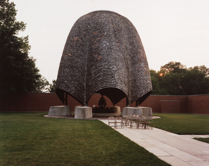
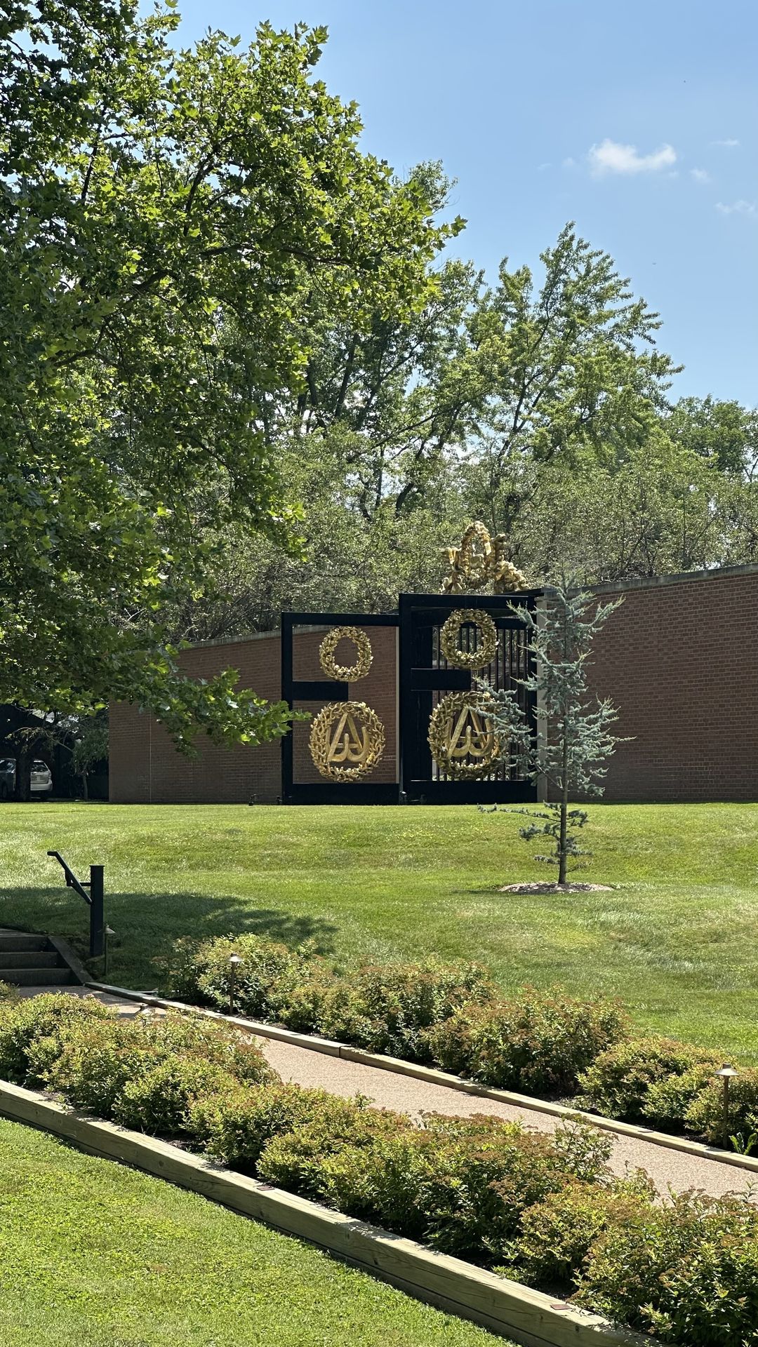
In the quiet town of New Harmony, Indiana, nestled along the banks of the Wabash River, stands an unusually striking open-air church, known as the Roofless Church. Completed in 1960, this unique structure was designed by modernist architect Philip Johnson, commissioned by philanthropist Jane Blaffer Owen, whose vision was to create a space where “only the sky could serve as the roof.” The idea behind the project was that no church could have a better roof than one open to the heavens, which was created by God himself.
The town of New Harmony itself has a fascinating history that puts the Roofless Church a little more into context. Founded in the early 19th century as a utopian religious community, it was first established by the Harmony Society, a German pietist religious group seeking spiritual purity and communal living. Later, in 1825, the Scottish industrialist and social reformer Robert Owen purchased the town, transforming it into an experiment in education, science, and humanist ideals. Although Owen’s utopia eventually dissolved, the town remains, peaceful and quiet, to this day with many of its original qualities that resonate in the Roofless Church’s serene design.
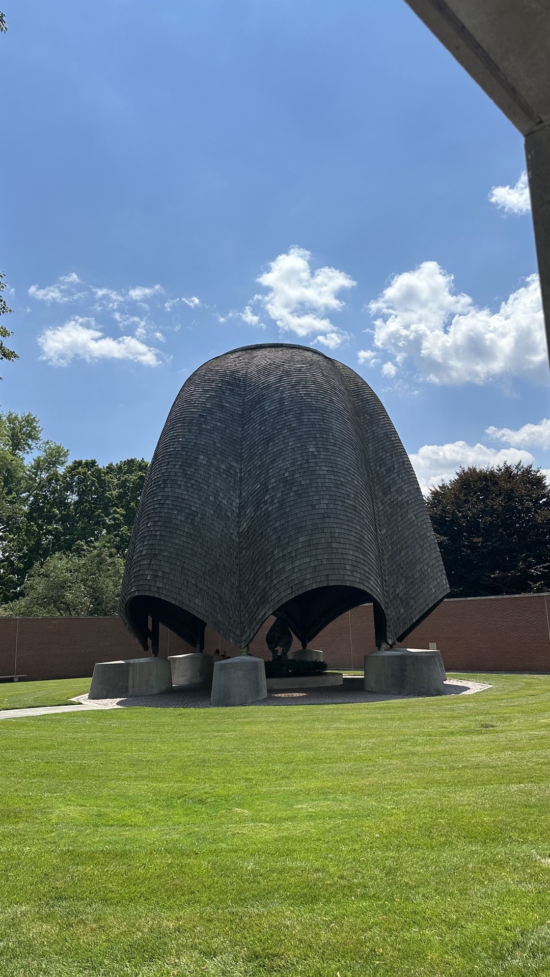
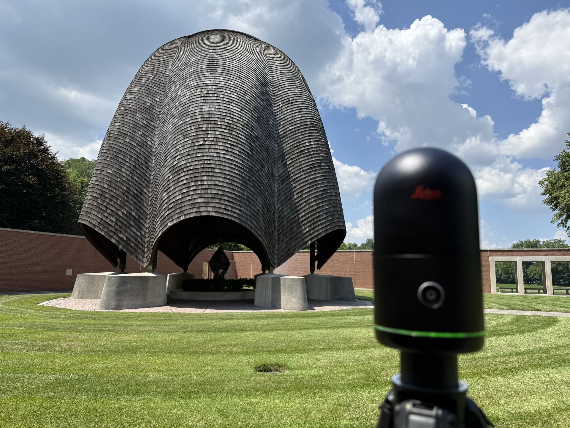
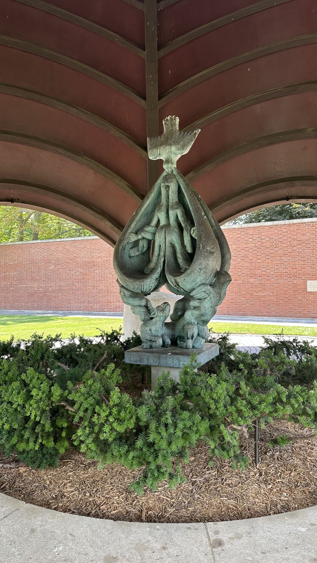
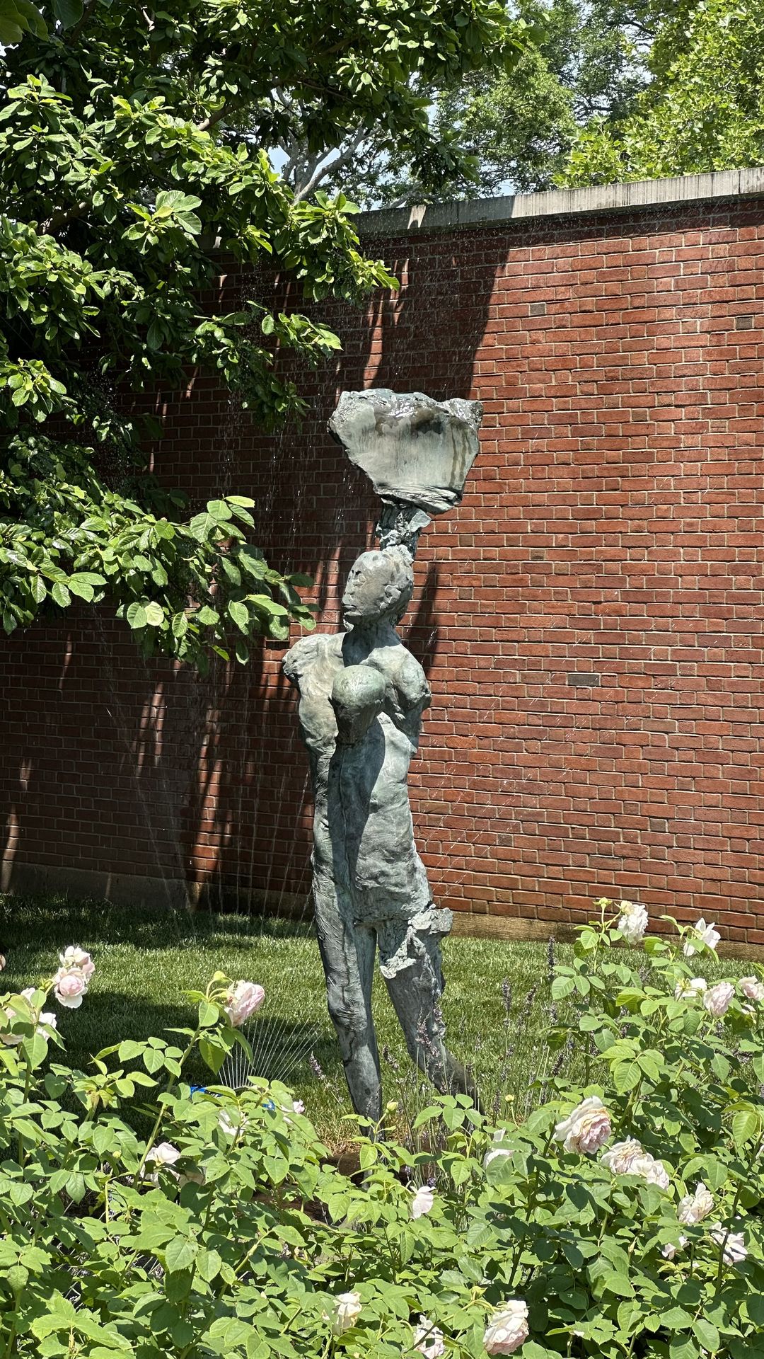
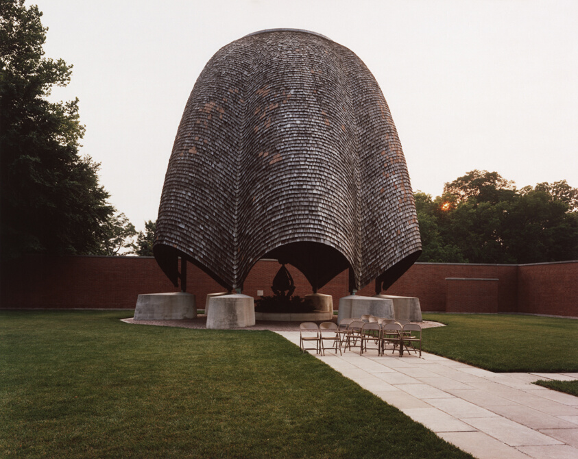
The structure itself is enclosed by high brick walls forming a trapezoidal courtyard that opens to the sky. At its heart stands a bronze sculpture by Jacques Lipchitz, titled The Descent of the Holy Spirit, sheltered under a circular cedar-shingled canopy. Around the courtyard, pathways, reflecting pools, and gardens add a vibrant splash of nature to the otherwise very simplistic geometry. The space is intentionally minimal to encourage reflection and unity.
Workflow of scanning the Roofless Church
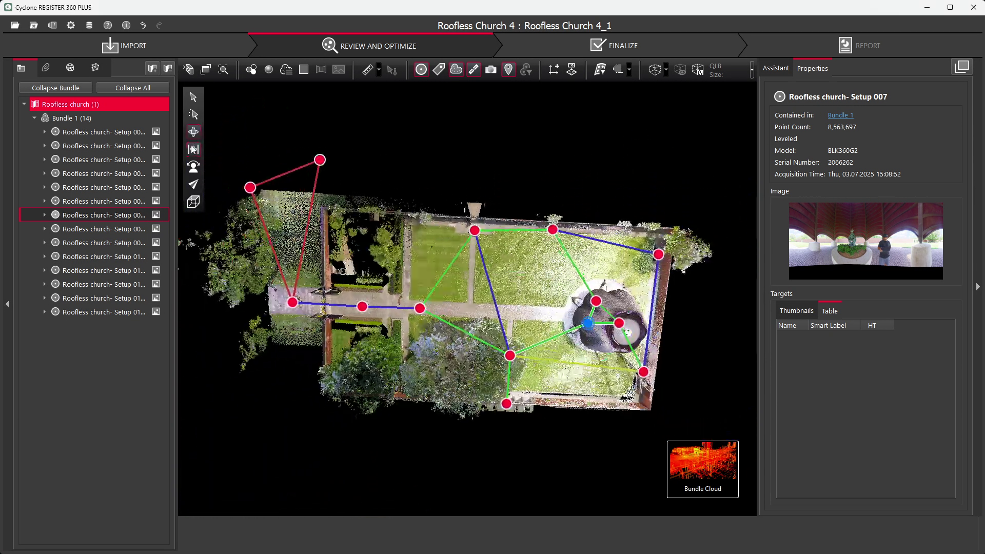
In July of 2025, the R-E-A-L.iT team had the opportunity to digitally capture this landmark using the Leica BLK360 G2, one of the most advanced terrestrial reality-capture instruments available. The goal was to preserve the physical form of the Roofless Church but also to document its spatial atmosphere.
Before scanning, we planned our setup strategy to ensure complete coverage of both the architectural and sculptural elements. Because the site features a combination of open-air and enclosed geometries, we chose to perform a series of overlapping scans from transitional points such as the entrance archway, the Lipchitz sculpture canopy, and along the perimeter walkways. The BLK360 G2’s HDR imagery mode was enabled throughout to capture the vivid colour as accurately as possible, allowing the data later to be used for a digital walkthrough, maintaining the visual authenticity of the environment.
Interested in the BLK360 G2?
You can learn more about the scanner we used on its dedicated page.
When working with outdoor heritage structures like the Roofless Church, environmental challenges such as changing sunlight, shadows, and reflective surfaces can complicate registration. To counter this, we kept a consistent scan overlap of 30–40% and used natural alignment references like pathway edges and column corners. If you plan to scan a site with multiple scans, while using the HDR imagery option, be sure to conduct all the scans in similar lighting conditions, ideally in flat lighting.
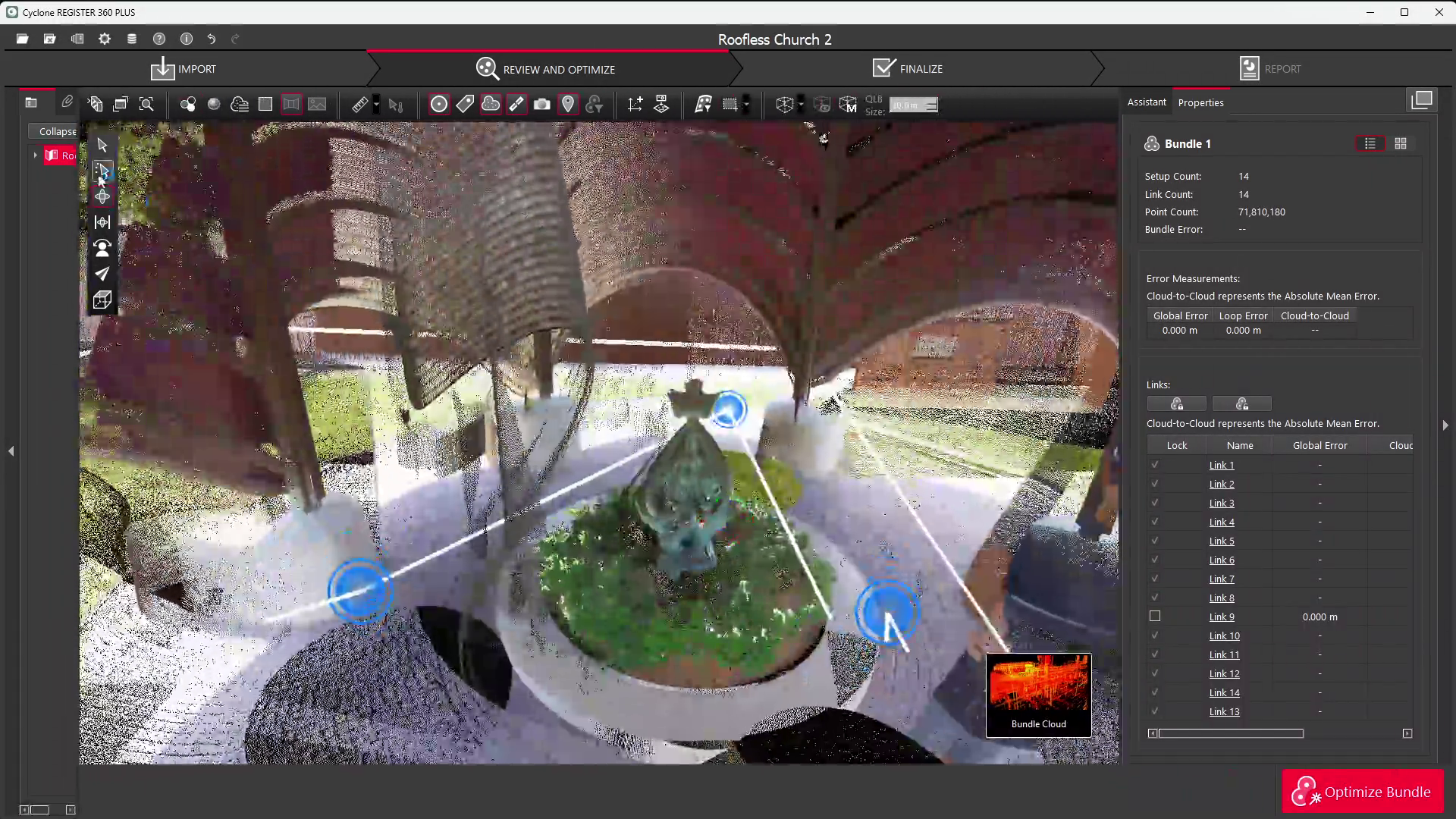
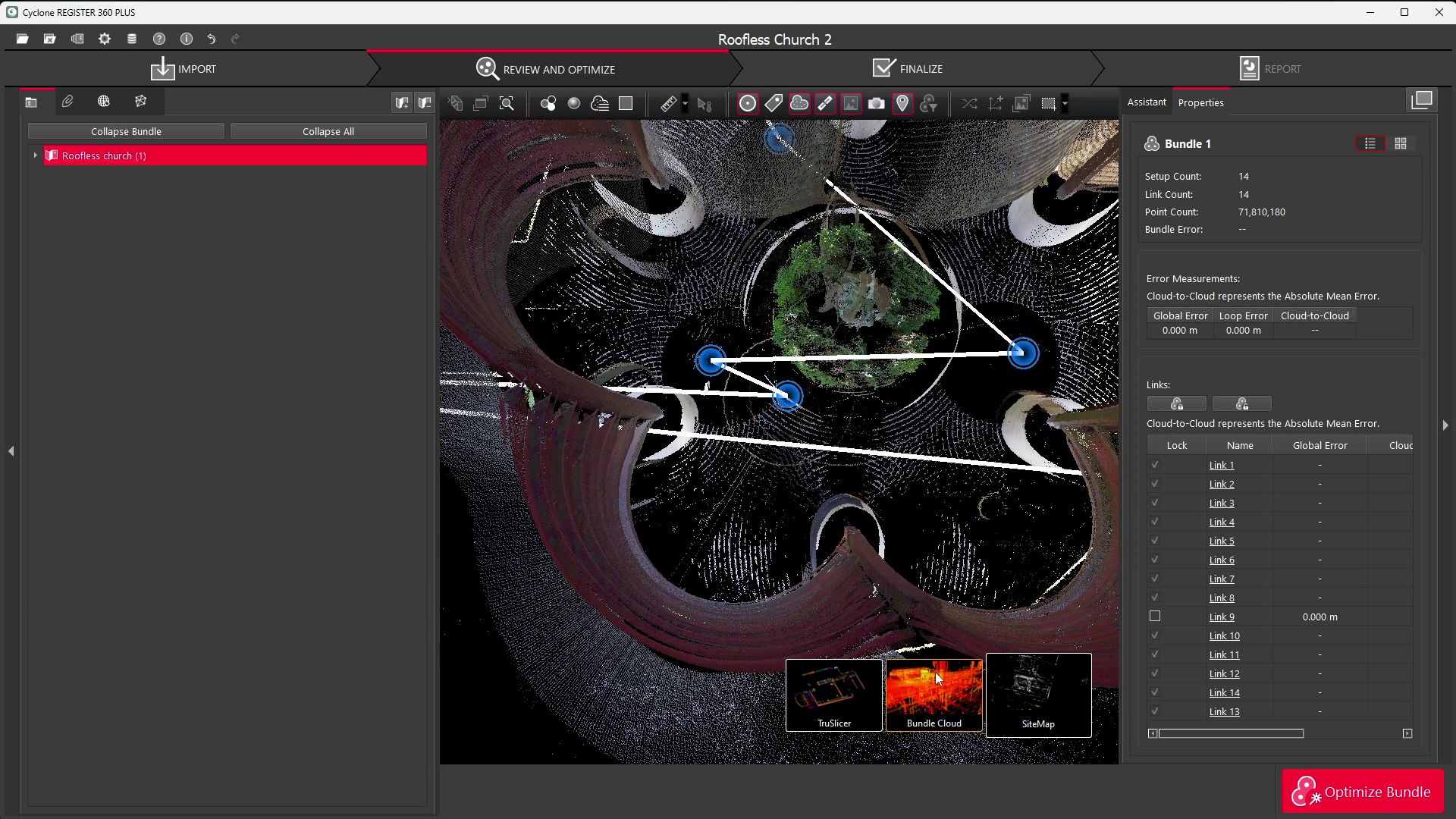
Once the BLK360 G2 survey was complete, we began the data ingestion process by downloading the raw point cloud data via Leica’s BLK Data Manager, converting it into compatible formats such as E57 and LAS, along with the HDR imagery sets. The registered datasets were then imported into Leica Cyclone REGISTER 360, which remains our preferred software for scan alignment, cleanup, and optimization.
Registering and cleaning the data
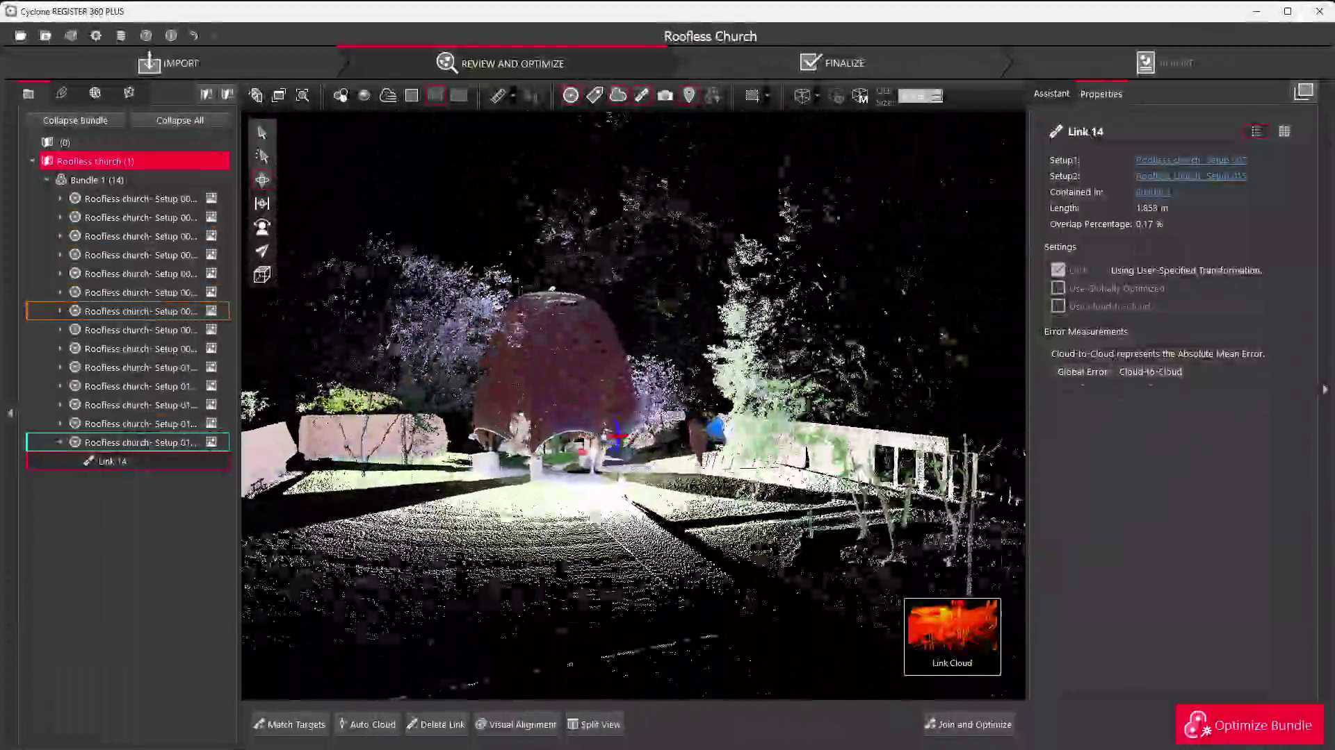
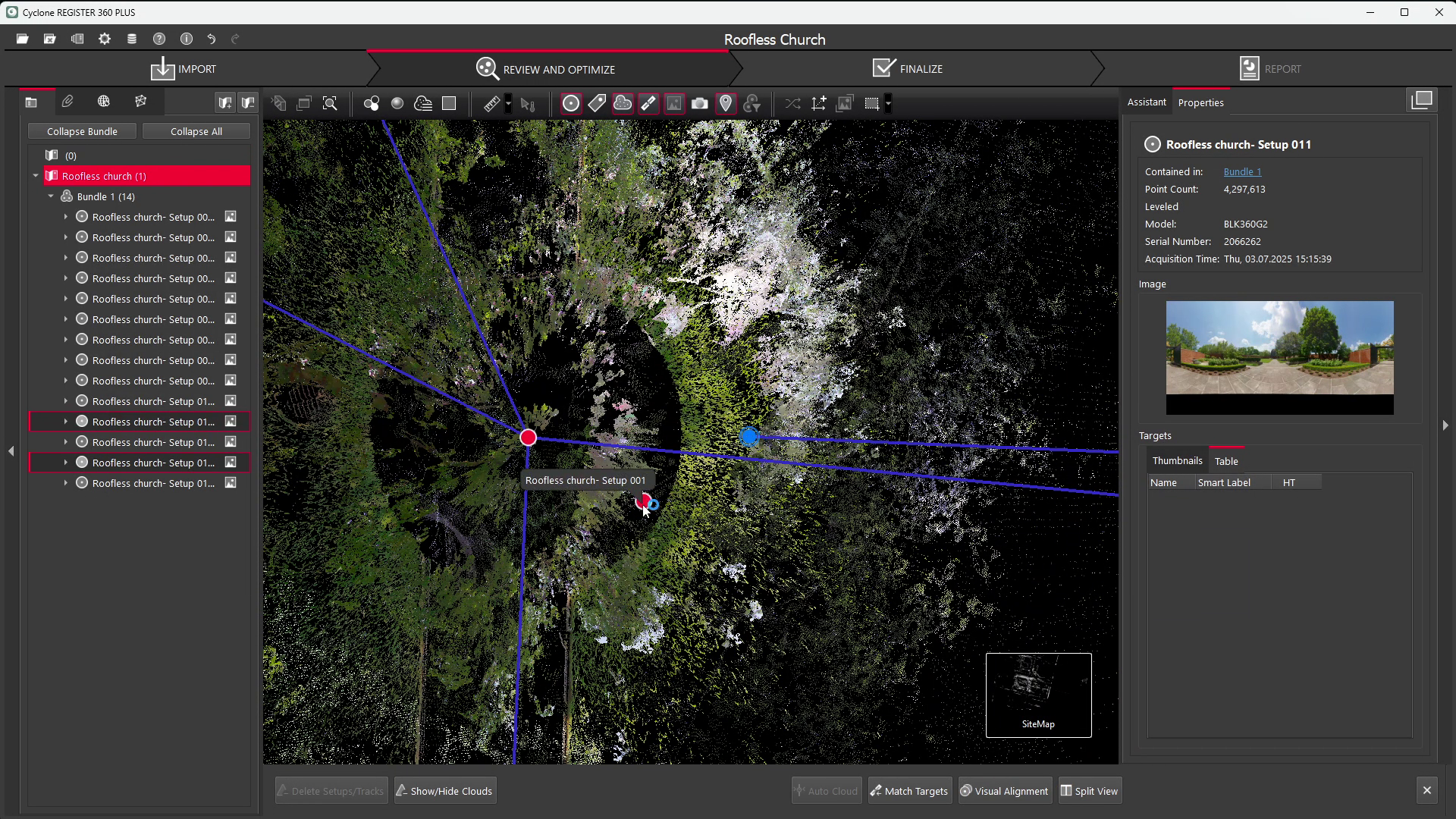
During registration, individual scan positions were stitched together to create a unified model of the site, ensuring perfect spatial continuity between the open courtyard, the canopy structure, and the surrounding walls. After achieving alignment, we used REGISTER 360’s “Detect Moving Objects” feature to automatically filter out transient artefacts such as passing pedestrians or tree movements captured between scans. Manual refinement followed, where we selectively removed small inconsistencies or reflective noise from the metallic surfaces of the sculpture.
Once the scene was cleaned, we proceeded with geometry and imagery optimization. While redundant point density was reduced in flat areas like the outer brick walls and courtyard paving, we retained maximum resolution in detailed zones, particularly around the Lipchitz sculpture and canopy structure, where organic forms and fine surface details required full fidelity. HDR imagery was applied to the point cloud, preserving the warm brick tones and the play of sunlight filtering through the canopy.
Finally, the dataset was exported as a high-quality deliverable suitable for various applications, ranging from precise measurement and restoration documentation to virtual walkthroughs and cultural heritage archives. Depending on project goals, this can include colorized point clouds, meshed 3D models, or web-optimized visualizations for public exhibition. In our case, we used Reality Cloud Studio for presenting the finished point cloud as it's the best option for sharing data of this size over the internet.
The Roofless Church is more than a monument, it is a living symbol of openness, harmony, and the human search for unity through art and architecture. Capturing it with the BLK360 G2 allowed us to bridge history and technology, preserving both the tangible craftsmanship of Philip Johnson’s design and the intangible serenity of its space. Projects like this underscore how reality capture tools such as Leica’s scanners can play an essential role not only in industrial surveying but in the digital preservation of our shared cultural heritage.