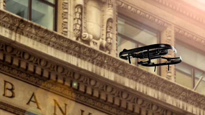
SURVEYING

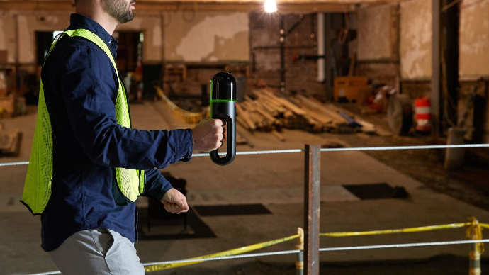
Streamline your construction workflow by capturing millimetre accurate models of any as built structure.

Learn More

Customers we've served

Countless general contractors have already used our solutions to enhance their workflows. 


EllisDon Construction
Canada

Bird Construction
Canada

Pomerleau Inc.
Canada

PCL Construction
Canada

Kenaidan Construction
Canada

Canatal Industries
Canada

Captura tu mundo, más rápido que nunca.


Surveying projects depend on accurate measurements delivered on tight timelines. Reality capture technologies such as 3D laser scanning and mobile mapping systems allow surveyors to collect precise data quickly, even across large or complex sites. Instead of relying solely on traditional measurement methods, surveyors can capture millions of data points in minutes and generate highly detailed site models ready for analysis and reporting.

Faster data collection reduces time spent in the field while improving accuracy and consistency across projects. This allows surveying professionals to deliver reliable results more efficiently, support demanding project schedules, and maintain the high standards expected in modern surveying workflows.

Improve Accuracy and Deliver Reliable Results


Precision is the foundation of professional surveying. Even small measurement errors can lead to costly delays, design conflicts, or construction issues. Reality capture provides highly accurate spatial data that supports dependable surveying deliverables, including topographic surveys, boundary documentation, and infrastructure mapping.

By working from detailed digital data, surveyors can verify measurements, detect discrepancies, and ensure that survey results meet required specifications. Reliable data improves confidence in project decisions and helps clients move forward with planning, design, and construction activities without uncertainty.

Survey Complex Sites with Confidence


Surveying environments often include difficult terrain, restricted access areas, and hazardous conditions. Reality capture technologies enable surveyors to document these environments safely and efficiently using tools such as terrestrial scanners, mobile mapping systems, and drones.

These technologies make it possible to capture accurate measurements from locations that would otherwise be dangerous or time-consuming to access. By reducing the need for repeated site visits and manual measurements, surveyors can complete projects faster while maintaining safety and data quality.

Modern reality capture tools can significantly reduce fieldwork time compared to traditional methods, allowing survey teams to work more efficiently on large infrastructure or land development projects.

Streamline Surveying Workflows


Surveying workflows involve multiple stages, from field data collection to processing and deliverable generation. Reality capture simplifies these workflows by providing comprehensive datasets that can be processed, analyzed, and shared across teams quickly.

With accurate digital information available from the start, surveyors can reduce rework, accelerate project timelines, and improve coordination with engineers, architects, and construction teams. Streamlined workflows help surveyors handle more projects, improve turnaround times, and maintain consistent productivity across operations.

Support Land Development and Infrastructure Projects


Surveying plays a critical role in land development, transportation, utilities, and infrastructure planning. Reality capture technologies provide detailed site information that supports planning, design, and long-term asset management.

Accurate digital site models allow project teams to evaluate terrain conditions, plan construction activities, and monitor progress throughout the project lifecycle. These models also support the creation of digital twins and long-term infrastructure records, helping organizations manage assets more effectively and make better decisions over time. 

Deliver Survey-Grade Data Faster with Modern Reality Capture


Clients increasingly expect faster turnaround times without sacrificing accuracy. Reality capture allows surveyors to deliver survey-grade data quickly by combining advanced scanning technology with efficient processing workflows.

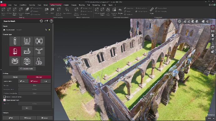
By capturing high-density data in a single site visit, surveyors can reduce field time, minimize disruptions, and provide deliverables such as point clouds, surface models, and georeferenced maps sooner. Faster delivery improves client satisfaction, strengthens project coordination, and gives surveying firms a competitive advantage in a demanding market.

Scanners perfect for surveying

See some of our product line that are tailored for engineers below.

Your Dynamic Snippet will be displayed here... This message is displayed because you did not provided both a filter and a template to use.

Lo que dicen nuestros clientes

Con la confianza de empresas en todo Canadá y Estados Unidos.

RH Borden
Lehi, Utah

“La asistencia de R-E-A-L.iT para ayudar a RH Borden a aprovechar al máximo la tecnología de captura de realidad para nuestro negocio nos ha ayudado a entregar resultados excepcionales a nuestros clientes. El script de software personalizado que el equipo de R-E-A-L.iT creó para nosotros nos permite entregar productos finales de alta calidad a nuestros clientes en tiempo récord.”

Jon Borden CEO / RH Borden
Point3D
Ottawa, Ontario

“R-E-A-L.iT ha sido nuestra fuente dedicada para todos los productos Leica Geosystems desde hace tiempo, y no podríamos estar más satisfechos con el servicio que hemos recibido. Su equipo demuestra un conocimiento apasionado de los productos y un buen dominio de las últimas novedades de la industria. Derek siempre ha sido rápido, cortés y muy servicial. Seguiremos comprando y alquilando escáneres láser 3D Leica Geosystems con R-E-A-L.iT.”

Spencer MacPherson CEO / Point3D
Slate Architecture
Helena, Montana

“Hemos disfrutado mucho trabajar con R-E-A-L.iT: alquilar equipos de captura de realidad a través de su equipo ha sido una experiencia fluida y confiable que nos ayuda a mantenernos ágiles y eficientes en nuestros proyectos. El equipo es de primera calidad, y su servicio facilita concentrarnos en el trabajo que tenemos por delante.”

Warren Curry Arquitecto / Slate Architecture
TELUS Communications
Calgary, Alberta

“A diferencia de algunas experiencias de venta, Derek y su equipo han estado constantemente disponibles para nosotros tanto antes como después de la venta, colaborando con TELUS en la implementación de aplicaciones complejas y a largo plazo de soluciones de captura de realidad para nuestro negocio.”

Patrick Provost Representante técnico de campo / TELUS Communications

RH Borden
Lehi, Utah

“La asistencia de R-E-A-L.iT para ayudar a RH Borden a aprovechar al máximo la tecnología de captura de realidad para nuestro negocio nos ha ayudado a entregar resultados excepcionales a nuestros clientes. El script de software personalizado que el equipo de R-E-A-L.iT creó para nosotros nos permite entregar productos finales de alta calidad a nuestros clientes en tiempo récord.”

Jon Borden CEO / RH Borden
Point3D
Ottawa, Ontario

“R-E-A-L.iT ha sido nuestra fuente dedicada para todos los productos Leica Geosystems desde hace tiempo, y no podríamos estar más satisfechos con el servicio que hemos recibido. Su equipo demuestra un conocimiento apasionado de los productos y un buen dominio de las últimas novedades de la industria. Derek siempre ha sido rápido, cortés y muy servicial. Seguiremos comprando y alquilando escáneres láser 3D Leica Geosystems con R-E-A-L.iT.”

Spencer MacPherson CEO / Point3D
Slate Architecture
Helena, Montana

“Hemos disfrutado mucho trabajar con R-E-A-L.iT: alquilar equipos de captura de realidad a través de su equipo ha sido una experiencia fluida y confiable que nos ayuda a mantenernos ágiles y eficientes en nuestros proyectos. El equipo es de primera calidad, y su servicio facilita concentrarnos en el trabajo que tenemos por delante.”

Warren Curry Arquitecto / Slate Architecture
TELUS Communications
Calgary, Alberta

“A diferencia de algunas experiencias de venta, Derek y su equipo han estado constantemente disponibles para nosotros tanto antes como después de la venta, colaborando con TELUS en la implementación de aplicaciones complejas y a largo plazo de soluciones de captura de realidad para nuestro negocio.”

Patrick Provost Representante técnico de campo / TELUS Communications

Ready to get started capturing your reality?

Contact us now for more information or to get started on your reality capture journey.