INGEGNERIA

Streamline your construction workflow by capturing millimetre accurate models of any as built structure.

Learn More

Customers we've served

Numerose società di ingegneria hanno già scelto le nostre soluzioni per migliorare i propri workflow. 


EllisDon Construction
Canada

Bird Construction
Canada

Pomerleau Inc.
Canada

PCL Construction
Canada

Kenaidan Construction
Canada

Canatal Industries
Canada

Capture your world, faster than ever.


I progetti di ingegneria si basano su dati accurati per progettazione, analisi e pianificazione delle infrastrutture nel lungo periodo. Tecnologie di reality capture come la scansione laser 3D consentono agli ingegneri di raccogliere rapidamente misure precise dello stato di fatto, base affidabile per calcoli e sviluppo del progetto.

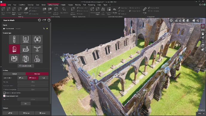
Acquisendo milioni di punti in poco tempo, i team di ingegneria creano modelli digitali dettagliati di strutture e infrastrutture, migliorando la precisione progettuale e riducendo i sopralluoghi ripetuti. Un rilievo rapido e affidabile aiuta a prendere decisioni consapevoli prima, riducendo rischi e incertezze.

Aumenti la Sua efficienza


I workflow di ingegneria comportano spesso una documentazione complessa del sito, misure e coordinamento tra più discipline. La reality capture snellisce questi processi fornendo dati accurati e completi, condivisibili all’istante tra i team.

With reliable digital documentation available from the start, engineers can reduce manual surveying time, accelerate design development, and improve coordination between project stakeholders. Studies have shown that modern reality capture technologies can significantly reduce fieldwork time while improving data quality, allowing engineering teams to focus on solving problems rather than collecting measurements.

Monitoraggio e manutenzione, con precisione e semplicità


Infrastrutture come ponti, strade, gallerie e impianti industriali richiedono un monitoraggio continuo per garantirne sicurezza e prestazioni. La reality capture consente di creare archivi digitali molto dettagliati di questi asset, semplificando il controllo delle variazioni strutturali e la pianificazione della manutenzione.

Acquisendo dati di riferimento accurati e confrontandoli nel tempo con nuove scansioni, gli ingegneri rilevano deformazioni, cedimenti o usura prima che diventino critici. Questo monitoraggio proattivo migliora la gestione degli asset, riduce i costi di manutenzione e contribuisce a prolungare la vita utile delle infrastrutture. 

Prima di tutto la sicurezza. Sempre.


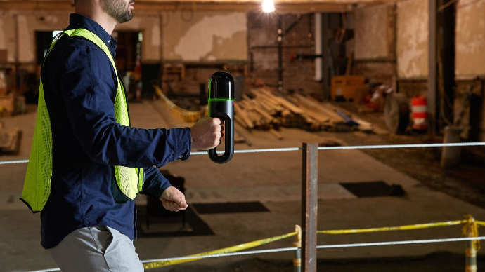
I progetti di ingegneria coinvolgono spesso ambienti pericolosi, come strutture in quota, spazi confinati e cantieri attivi. La reality capture riduce i rischi consentendo di raccogliere dati a distanza, senza esporre il personale a pericoli inutili.

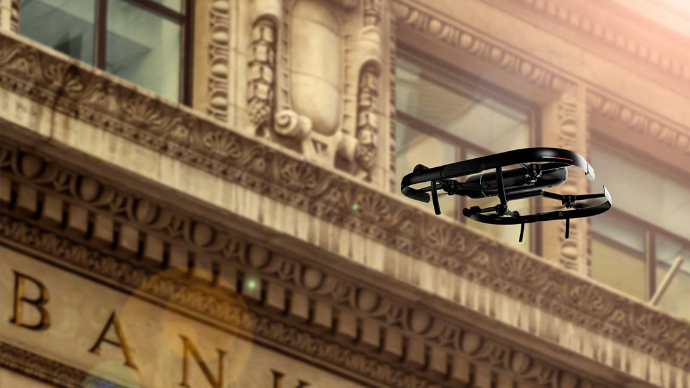
Con scansione laser, droni e sistemi di mobile mapping, i team ispezionano le infrastrutture in sicurezza a distanza, mantenendo piena visibilità sullo stato del sito. Questo approccio migliora la sicurezza dei lavoratori, favorisce il rispetto delle normative e riduce i fermi dovuti ad accessi limitati o condizioni pericolose.

Visualizzazioni migliori


Le decisioni ingegneristiche sono spesso complesse e richiedono una comunicazione chiara tra progettisti, project manager e stakeholder. La reality capture fornisce modelli 3D e visualizzazioni molto dettagliati che facilitano la comprensione del contesto e la valutazione delle alternative progettuali.

Queste visualizzazioni permettono di presentare le informazioni tecniche in modo chiaro e accessibile, aiutando gli stakeholder a esaminare i progetti, individuare potenziali criticità e approvare i piani con sicurezza. Una visualizzazione migliore porta a una collaborazione più efficace, approvazioni più rapide e consegne più efficienti.


Monitoraggio e manutenzione migliori


Gli asset ingegneristici vanno gestiti lungo tutto il ciclo di vita, dalla costruzione all’esercizio e alla manutenzione nel lungo periodo. La reality capture fornisce archivi digitali accurati a supporto di strategie di manutenzione predittiva e monitoraggio delle condizioni.

Acquisendo e analizzando regolarmente i dati delle infrastrutture, gli ingegneri individuano le tendenze prestazionali, stabiliscono le priorità degli interventi e ottimizzano i programmi di manutenzione in base alle condizioni reali. Questo approccio basato sui dati migliora l’affidabilità, riduce i guasti imprevisti e mantiene le infrastrutture sicure e operative nel tempo.

Scanner ideali per l’ingegneria

Qui sotto alcuni prodotti della nostra gamma pensati per gli ingegneri.

Your Dynamic Snippet will be displayed here... This message is displayed because you did not provided both a filter and a template to use.

What Our Clients Say

Trusted by companies across Canada and the United States.

RH Borden
Lehi, Utah

“R-E-A-L.iT’s assistance in helping RH Borden to get the most out of reality capture technology for our business has helped us deliver exceptional results for our clients. The custom software script that R-E-A-L.iT’s team created for us is enabling us to get high-quality deliverables into the hands of our clients in record time.”

Jon Borden CEO / RH Borden
Point3D
Ottawa, Ontario

“R-E-A-L.iT has been our dedicated source for all Leica Geosystems products for some time and we couldn’t be happier than with the service we’ve received. Their team shows passionate product knowledge and a handle on the latest in the latest industry. Derek has always been quick, courteous and very helpful. We will continue to purchase and rent Leica Geosystems 3D laser scanners with R-E-A-L.iT.”

Spencer MacPherson CEO / Point3D
Slate Architecture
Helena, Montana

“We’ve really enjoyed working with R-E-A-L.iT — renting reality capture gear through your team has been a smooth, reliable experience that helps us stay agile and efficient on our projects. The equipment is top-notch, and your service makes it easy to focus on the work at hand.”

Warren Curry Architect / Slate Architecture
TELUS Communications
Calgary, Alberta

“Unlike with some sales experiences, Derek and his team have been constantly available to us both pre- and post-sale, partnering with TELUS in implementing complex and long-term applications of reality capture solutions to our business.”

Patrick Provost Technical Field Representative / TELUS Communications
RH Borden
Lehi, Utah

“R-E-A-L.iT’s assistance in helping RH Borden to get the most out of reality capture technology for our business has helped us deliver exceptional results for our clients. The custom software script that R-E-A-L.iT’s team created for us is enabling us to get high-quality deliverables into the hands of our clients in record time.”

Jon Borden CEO / RH Borden
Point3D
Ottawa, Ontario

“R-E-A-L.iT has been our dedicated source for all Leica Geosystems products for some time and we couldn’t be happier than with the service we’ve received. Their team shows passionate product knowledge and a handle on the latest in the latest industry. Derek has always been quick, courteous and very helpful. We will continue to purchase and rent Leica Geosystems 3D laser scanners with R-E-A-L.iT.”

Spencer MacPherson CEO / Point3D
Slate Architecture
Helena, Montana

“We’ve really enjoyed working with R-E-A-L.iT — renting reality capture gear through your team has been a smooth, reliable experience that helps us stay agile and efficient on our projects. The equipment is top-notch, and your service makes it easy to focus on the work at hand.”

Warren Curry Architect / Slate Architecture
TELUS Communications
Calgary, Alberta

“Unlike with some sales experiences, Derek and his team have been constantly available to us both pre- and post-sale, partnering with TELUS in implementing complex and long-term applications of reality capture solutions to our business.”

Patrick Provost Technical Field Representative / TELUS Communications

Ready to get started capturing your reality?

Contact us now for more information or to get started on your reality capture journey.