Building Construction and BIM
For interiors, facades and scan-to-BIM work, where spaces are enclosed and the scanner is rarely far from its target. The RTC300 covers this work with an 85m range and 1 million pts/s.
New - 2026
One series. Three performance tiers. A laser scanner built for every operator, every worksite, and every scale of project.
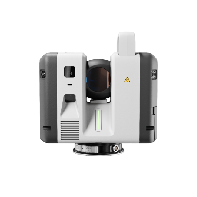
Performance optimized for agile execution — engineered for speed and rugged field-first reality capture.
Max Range
85m
Scan Rate
1M pts/s
3D Accuracy
1.5 mm @ 10m
Tilt Accuracy
3″ up to ±10°
Thank you! Our team will contact you shortly.
Thank you! Our team will contact you shortly.
Why buy from REALiT Capture Solutions
Performance and operational flexibility for diverse environments and general surveying workflows.
Max Range
130m
Scan Rate
2M pts/s
3D Accuracy
1.5 mm @ 10m
Tilt Accuracy
3″ up to ±10°
Thank you! Our team will contact you shortly.
Thank you! Our team will contact you shortly.
Why buy from REALiT Capture Solutions
Long range, Area Scan detail and the full on-scanner survey suite for large-scale infrastructure and complex engineering.
Max Range
270m
Scan Rate
2M pts/s
3D Accuracy
1.5 mm @ 10m
Area Scan
0.8 mm @ 10m resolution
Thank you! Our team will contact you shortly.
Thank you! Our team will contact you shortly.
Only need a scanner for one project? Rent an RTC700 →
Why buy from REALiT Capture Solutions
Side-by-Side
Looking for an RTC360? We have limited remaining stock. Contact us.
| RTC300 Built for agile reality capture | RTC500 Versatile across diverse environments | RTC700 Long range for complex engineering projects | |
|---|---|---|---|
| Max Range | 85m | 130m | 270m |
| Scan Rate | 1 million pts/sec | 2 million pts/sec | 2 million pts/sec |
| Resolution | 3, 6, 12, 25 mm @ 10m | 3, 6, 12, 25 mm @ 10m | 0.8, 1.6, 3, 6, 12, 25 mm @ 10m |
| 3D Accuracy | 1.5 mm @ 10m / 3.8 mm @ 50m | 1.5 mm @ 10m / 3.8 mm @ 50m | 1.5 mm @ 10m / 3.8 mm @ 50m |
| Tilt Accuracy | 3″ for ±10° | 3″ for ±10° | 3″ for ±10° |
| Workflow Focus | In-field focused | Operational flexibility | Advanced expert workflows |
| Key Applications | Building construction and agile QA/QC | Surveying, infrastructure and public safety | Large-scale plants and complex engineering |
Need a scanner for one project? We rent complete Leica RTC700 laser scanner kits with flexible schedules, delivery planned around your project dates, and tech support.
Flexible dates
Custom quote
US orders: prices shown are estimates. Applicable sales taxes are calculated after you order, and we'll contact you with a final quote, including taxes, before shipping.
Insurance covering loss of or damage to the rented equipment for its full replacement value (which varies by scanner) is required, and proof of it must be provided. Read our rental terms and conditions.
Easy support: we’re available by phone or email during regular business hours for questions or any tech problem.
Book an RTC700 rental or send us a question. We’ll get back to you with availability and pricing.
Confirm availability or request your rental. Start and end dates both count as rental days.
Ask us anything about renting the RTC700.
Measuring horizontal and vertical angles
Measuring distances
Scanning objects
Capturing and recording images
Recording measurements
Computing with software
Remote control of product
Data communication with external appliances
Move scan data from the field to the office quickly for registration and sharing. The RTC Series works with Leica Cyclone FIELD 360 and Leica Cyclone REGISTER 360 PLUS.
A 72 MP six-camera system captures 432 MP of raw HDR data per setup with 5-bracket HDR, producing a 360° × 300° spherical image in about 30 seconds to colourise your point clouds.
Rugged IP55-rated housing engineered for harsh jobsite conditions from −20 °C to +50 °C, with an integrated shock sensor for reliable capture through dust, rain, and demanding environments.
Control the scanner and tag scans in the field with the Leica Cyclone FIELD 360 app (iOS/Android).
Register and share your scans in the office with Leica Cyclone REGISTER 360 PLUS.
Model, inspect and report in Leica Cyclone 3DR, or work with point clouds in Autodesk Revit through Leica CloudWorx.
For interiors, facades and scan-to-BIM work, where spaces are enclosed and the scanner is rarely far from its target. The RTC300 covers this work with an 85m range and 1 million pts/s.
Tall, cluttered, pipe-dense spaces reward range and speed. With 2 million pts/s, the RTC500 (130m) and RTC700 (270m) can reach across a wide bay from a single setup.
Less time on scene matters when conditions are unstable and time is short. The RTC500’s 2 million pts/s helps capture a scene quickly.
On rail, tunnel and road corridors, the RTC700’s 270m range covers linear, hard-to-access areas in fewer setups. It adds setup over a known point, known backsight, resection, traverse and target measurements up to 75m.
| Mode | Resolution (@ 10m) | RTC300 | RTC500 | RTC700 |
|---|---|---|---|---|
| Fast | 25 mm | 0:26 | 0:13 | 0:13 |
| Low | 12 mm | 0:52 | 0:26 | 0:26 |
| Medium | 6 mm | 1:42 | 0:51 | 0:51 |
| High | 3 mm | 3:24 | 1:42 | 1:42 |
| Super High | 1.6 mm | — | — | 6:48 |
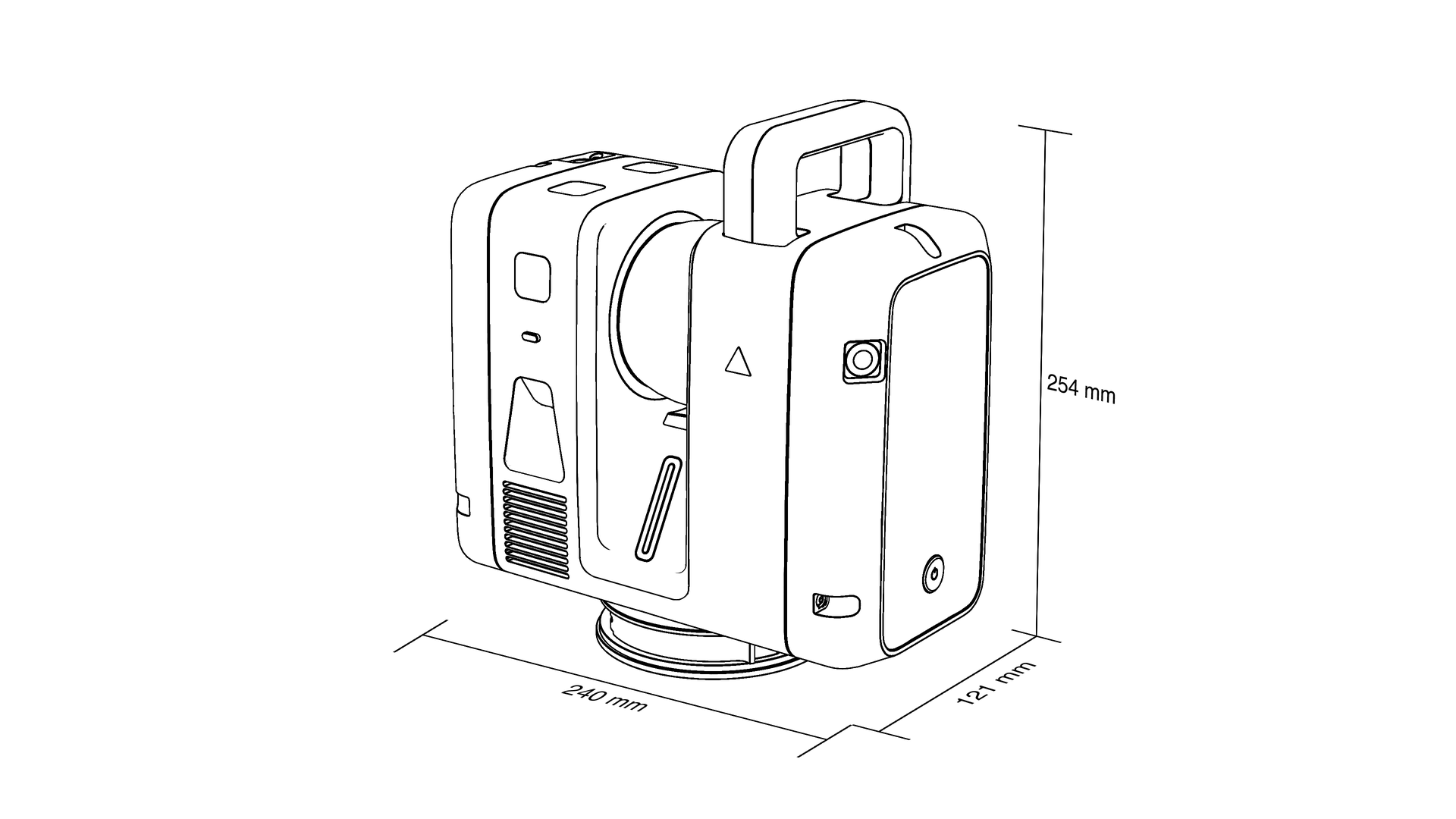
Dimensions and Drawings
6020227
consisting of:
6020225
consisting of:
6020224
consisting of:
Before you buy or rent
Trusted by companies across Canada and the United States.
“R-E-A-L.iT’s assistance in helping RH Borden to get the most out of reality capture technology for our business has helped us deliver exceptional results for our clients. The custom software script that R-E-A-L.iT’s team created for us is enabling us to get high-quality deliverables into the hands of our clients in record time.”
“R-E-A-L.iT has been our dedicated source for all Leica Geosystems products for some time and we couldn’t be happier with the service we’ve received. Their team shows passionate product knowledge and a handle on the latest in the industry. Derek has always been quick, courteous and very helpful. We will continue to purchase and rent Leica Geosystems 3D laser scanners with R-E-A-L.iT.”

“We’ve really enjoyed working with R-E-A-L.iT — renting reality capture gear through your team has been a smooth, reliable experience that helps us stay agile and efficient on our projects. The equipment is top-notch, and your service makes it easy to focus on the work at hand.”

“Unlike with some sales experiences, Derek and his team have been constantly available to us both pre- and post-sale, partnering with TELUS in implementing complex and long-term applications of reality capture solutions to our business.”
“R-E-A-L.iT’s assistance in helping RH Borden to get the most out of reality capture technology for our business has helped us deliver exceptional results for our clients. The custom software script that R-E-A-L.iT’s team created for us is enabling us to get high-quality deliverables into the hands of our clients in record time.”
“R-E-A-L.iT has been our dedicated source for all Leica Geosystems products for some time and we couldn’t be happier with the service we’ve received. Their team shows passionate product knowledge and a handle on the latest in the industry. Derek has always been quick, courteous and very helpful. We will continue to purchase and rent Leica Geosystems 3D laser scanners with R-E-A-L.iT.”
“We’ve really enjoyed working with R-E-A-L.iT — renting reality capture gear through your team has been a smooth, reliable experience that helps us stay agile and efficient on our projects. The equipment is top-notch, and your service makes it easy to focus on the work at hand.”
“Unlike with some sales experiences, Derek and his team have been constantly available to us both pre- and post-sale, partnering with TELUS in implementing complex and long-term applications of reality capture solutions to our business.”
Trusted by companies across Canada and the United States.
“R-E-A-L.iT’s assistance in helping RH Borden to get the most out of reality capture technology for our business has helped us deliver exceptional results for our clients. The custom software script that R-E-A-L.iT’s team created for us is enabling us to get high-quality deliverables into the hands of our clients in record time.”
“R-E-A-L.iT has been our dedicated source for all Leica Geosystems products for some time and we couldn’t be happier with the service we’ve received. Their team shows passionate product knowledge and a handle on the latest in the industry. Derek has always been quick, courteous and very helpful. We will continue to purchase and rent Leica Geosystems 3D laser scanners with R-E-A-L.iT.”
“We’ve really enjoyed working with R-E-A-L.iT — renting reality capture gear through your team has been a smooth, reliable experience that helps us stay agile and efficient on our projects. The equipment is top-notch, and your service makes it easy to focus on the work at hand.”
“Unlike with some sales experiences, Derek and his team have been constantly available to us both pre- and post-sale, partnering with TELUS in implementing complex and long-term applications of reality capture solutions to our business.”
“R-E-A-L.iT’s assistance in helping RH Borden to get the most out of reality capture technology for our business has helped us deliver exceptional results for our clients. The custom software script that R-E-A-L.iT’s team created for us is enabling us to get high-quality deliverables into the hands of our clients in record time.”
“R-E-A-L.iT has been our dedicated source for all Leica Geosystems products for some time and we couldn’t be happier with the service we’ve received. Their team shows passionate product knowledge and a handle on the latest in the industry. Derek has always been quick, courteous and very helpful. We will continue to purchase and rent Leica Geosystems 3D laser scanners with R-E-A-L.iT.”
“We’ve really enjoyed working with R-E-A-L.iT — renting reality capture gear through your team has been a smooth, reliable experience that helps us stay agile and efficient on our projects. The equipment is top-notch, and your service makes it easy to focus on the work at hand.”
“Unlike with some sales experiences, Derek and his team have been constantly available to us both pre- and post-sale, partnering with TELUS in implementing complex and long-term applications of reality capture solutions to our business.”
Learn more: Rent the Leica RTC700 · All scanner rentals
Tell us when suits you and one of our experts will reach out to set up a demo.
