P-SERIES
TERRESTRIAL REALITY CAPTURE EQUIPMENT
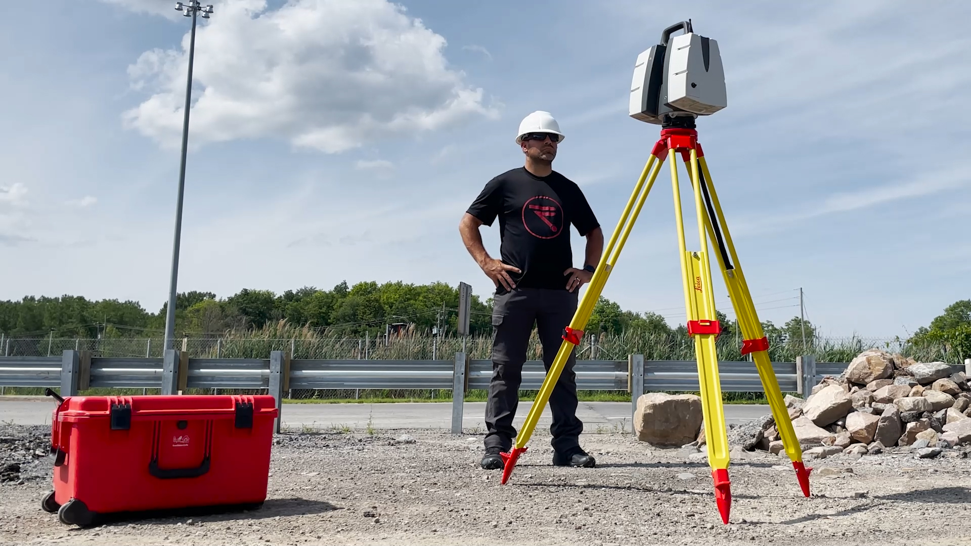
BE PRECISE
Integrated 3D laser scanning solution providing unsurpassed speed, accuracy and range for demanding scanning projects.
Your Professional Scanning Solution.
The most demanding and complex tasks call for the most powerful and reliable tools. The P-Series scanner from Leica Geosystems has everything you need to tackle the most difficult of scanning jobs.
Peak Performance and Repeatability - Every Time
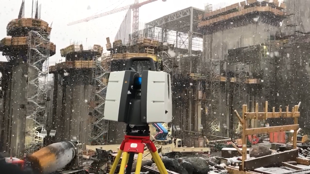
P-Series scanners deliver in every situation. Over long distances and in almsot any weather conditions, this line of scanners is tough enough to keep you working while delivering high quality, realiable, accurate, precise, and repeatable data. Reducing downtime, these extremely durable 3D laser scanners perform even under the toughest environmental conditions, such as extreme temperatures ranging from –20°C to +50°C and comply with the IP54 rating for dust and water resistance.
The Perfect Partner for Any Project
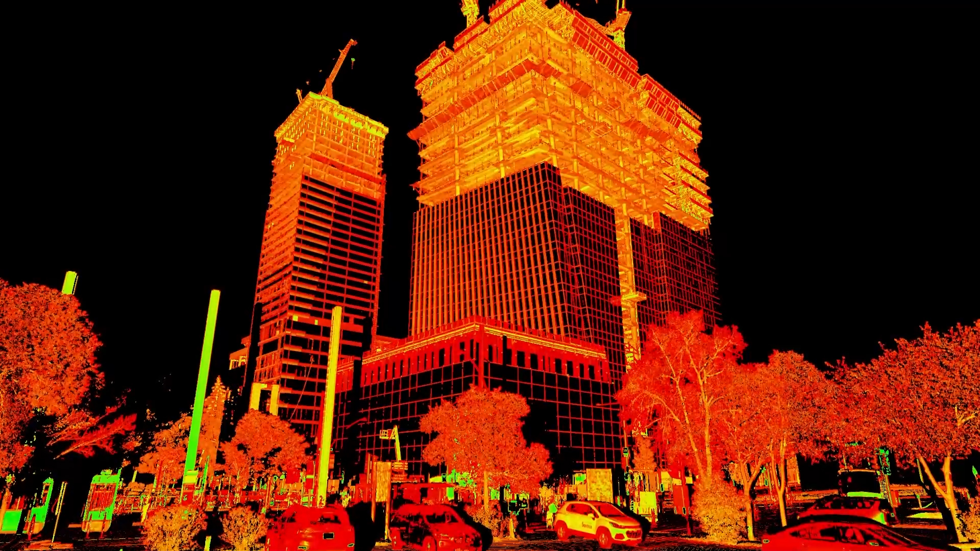
Leica ScanStation P-Series sacnners deliver highest quality 3D data and High-Dynamic Range (HDR) imaging at an extremely fast scan rate of 1 million points per second at ranges of up to 270m. Unsurpassed range and angular accuracy paired with low range noise and survey-grade dual-axis compensation form the foundation for highly detailed 3D colour point clouds mapped in realistic clarity.
Deliver Every Detail and Exceed Expectations
Whether you need a detailed as-built representation of a façade, a 2D floor plan, 3D data for integration into Building Information Modelling (BIM), capturing 3D geometry of roads, rails, tunnels and bridges or high-definition scan data for topographic maps and as-built surveys, you know you’ll need an accurate long range scanning tool for your projects – the ScanStation P-Series laser scanners from Leica Geosystems are the right choice, because every detail matters.
Everything You Need to Revolutionize Your Workflow
With Leica's complete P-Series solutions, jobs that used to take months can now take only hours. Work faster than ever before while gathering higher quality data than previously possible, all while remaining at a safe distance from crime scenes, dangerous equipment, or extreme heights. Leica's P-Series solutions are adaptable to your needs and reliably accurate - every time.
Meet the Tech.
Professional Quality, Professional Results
Highest quality HDR imaging and 3D data wtih incredible range, precision, and accuracy. Get repeatable results every time from the innovative and professional P-Series from Leica Geosystems.
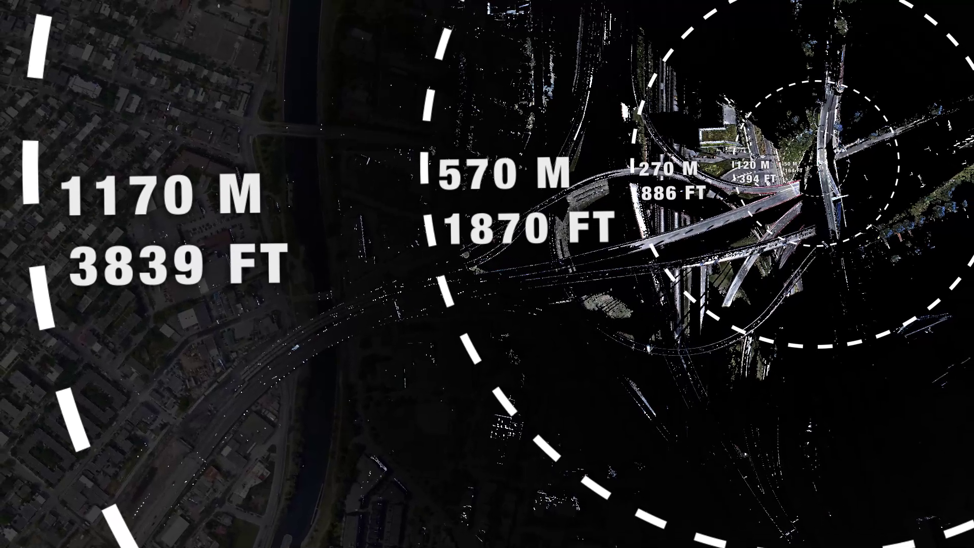
Long Range Terrestrial Scanning
With the greatest possible ranges in the industry, your P-Series scanner allows you to scan anywhere, safely and accurately.
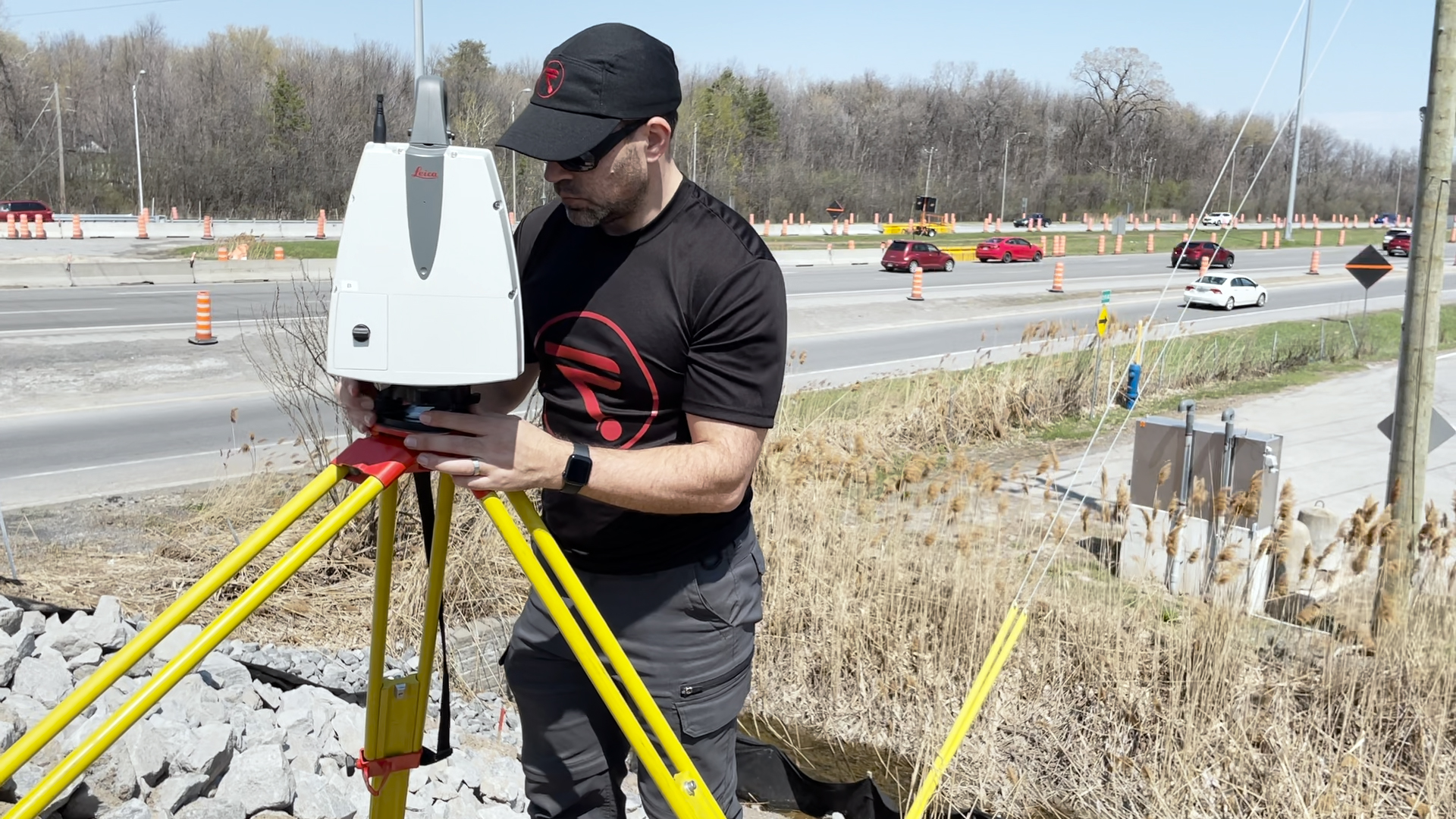
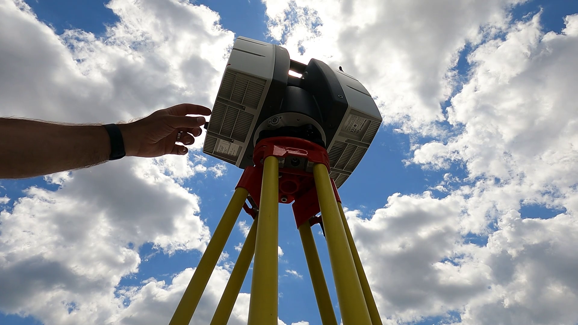
Tough and durable
With operating temperature ranges from -20 to 50 degrees celsius and IP54 rating for dust and water resistance, the P-Series can go wherever you can go.
Extremely fast scanninng
Gather 1 milion points per second even at ranges of over 1km with the P50.
Apply your data.
Surveying
The ScanStation P-Series 3D laser scanners are your perfect partner whether you are generating 3D data for integration into Building Information Modelling (BIM), capturing 3D geometry of civil infrastructure or creating an as-built representation of a large industrial complex. An accurate long-range scanning tool – up to 270 metres with the P30/P40 and up to 1km with the ScanStation P50 – you can capture data from further away when required. Capture data quickly at an extremely fast scan rate of 1 million points per second and feel confident to enter any environment, with hardware that performs even under the toughest environmental conditions.
Construction
Promote succesful vendor cooperation and manage all stages of your construction project with precision, ease, and speed. From site docusmentation to verifying as-built strucutres, the P-Series scanner will get you the reliable data you need to share with all your project stakeholders to avoid constly mistakes and delays.
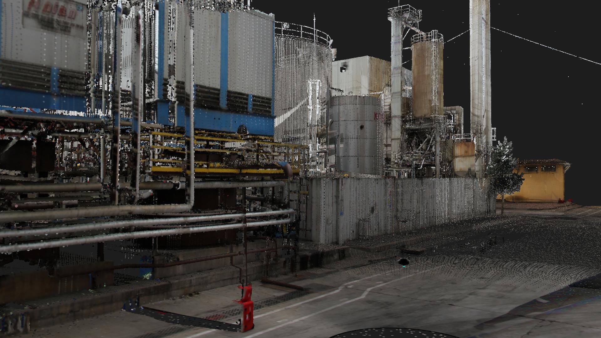
Power and Plant
Avoid the costly and time-consuing process of manually documenting as-built energy and plant sites by scanning your location with the PSeries scanner. Wtih millions of points gathered per second, you can take your data back to the office to document and plan maintenance, repair, and future plannign work without risks to your workers and without expensive delays and rework.
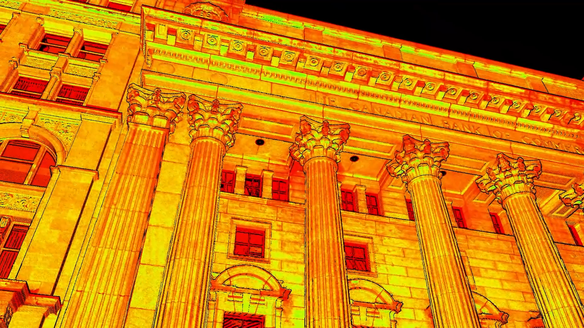
Heritage and Preservation
Document and preserve historical and archeological sites for posterity with the P-Series from Leica Geosystems. Avoid disturbances to your historical site and minimize interruption to other work happening on site but using a P-Series scanner to gather huge amounts of data which can then be processed back at your desk.
Specifications
DESIGN & PHYSICAL
Width: 358 mm (14.09 in.)
Height: 395 mm (15.55 in.)
Depth: 238 mm (9.37 in.)
WEIGHT
12.25 kg13.05 kg with battery
MOUNTING
Upright or invertedOPERATION
ON SCANNER
Full colour touchscreen for onboard scan control.CONTROL
Leica Cyclone FIELD 360 app for iPad or Android tablets including: Remote control of scan functions, 2D & 3D data viewing, Tagging, Automatic alignment of scans Remote control: Leica CS10/CS15 controller or any other remote desktop capable device, including iPad, iPhone and other SmartPhones; external simulator.WIRELESS
Integrated wirelessDATA STORAGE
256GB internal solid-state drive (SSD) or external USB devicePOWER
INTERNAL
2× Internal: Li-Ion 5.5hEXTERNAL
External > 7.5h (room temp.) External: Li-Ion (connect via external port, simultaneous use, hot swappable)SCANNING
DISTANCE MEASUREMENT
Ultra-high speed time-of-flight enhanced by Waveform Digitising (WFD) technology, 1550nm (invisible) / 658nm (visible) wavelengthLASER CLASS
1 (in accordance with IEC 60825:2014)FIELD OF VIEW
360 ° (HORIZONTAL)290 ° (VERTICAL)
RANGE
0.4 m (MIN)1170 m (MAX)
SPEED
Up to 1,000,000 pts/secDENSITY
7 user selectable settings (0.8/1.6/3.1/6.3/12.7/25/50mm @10m)IMAGING
CAMERA
4 megapixels per each 17°×17° colour image; 700 megapixels for panoramic image. Optional external camera (Canon EOS 60D/70D/80D supported)HDR
3 bracketsENVIRONMENTAL
OPERATING TEMPERATURE
–20 ° C (MIN)50 ° C (MAX)
STORAGE TEMPERATURE
–40 ° C (MIN )70 ° C (MAX)
IP RATING
Solid particle/liquid ingress protection IP54 (IEC 60529)NAVIGATION SENSORS
TILT
Dual-axis compensator. Liquid sensor with real-time onboard compensation, selectable on/off, resolution 1”, dynamic range ±5’, accuracy 1.5”ACCURACY
ANGULAR
8” horizontal; 8” verticalRANGE
0.4mm rms at 10m, 0.5mm rms at 50m3D POINT ACCURACY
1.6 mm @ 10 m1.9 mm @ 20 m
3 mm @ 50 m
DATA PROCESSING
DATA TRANSFER
Gigabit Ethernet, integrated Wireless LAN or USB 2.0 deviceDESKTOP SOFTWARE
Leica Cyclone REGISTER 360 PLUS (all versions)
Ready to learn more?
Our EXPERTS@R-E-A-L.iT are ready to help you with onboarding this new technology in your business. Whether you need to train your employees with this new hardware, or have questions about what software solutions to use in the office to get the most out of your data, we are ready to assist you at every step of the process. Check out our coaching plans here. Still have questions? Click the button below to start a conversation with one of our experts.
Contact Us.
-

-

-

-

Our
EXPERTS@R-E-A-L.iT
are ready to help you with onboarding this new technology in your business. Whether you need to train your employees with this new hardware, or have questions about what software solutions to use in the office to get the most out of your data, we are ready to assist you at every step of the process.
Still have questions? Click the button below to start a conversation with one of our experts.