PEGASUS:BACKPACK
EFFICIENT REALITY CAPTURE EQUIPMENT
BE VERSATILE
Versatile and wearable platform for indoor & outdoor reality capture
Portable, secure, and reliable reality capture
This unique mobile mapping solution is designed for rapid and regular reality capture. It is completely portable, enabling it to be checked in as luggage on a flight. The Pegasus:Backpack is designed to act a sensor platform with our standard external trigger and sync port outputs.
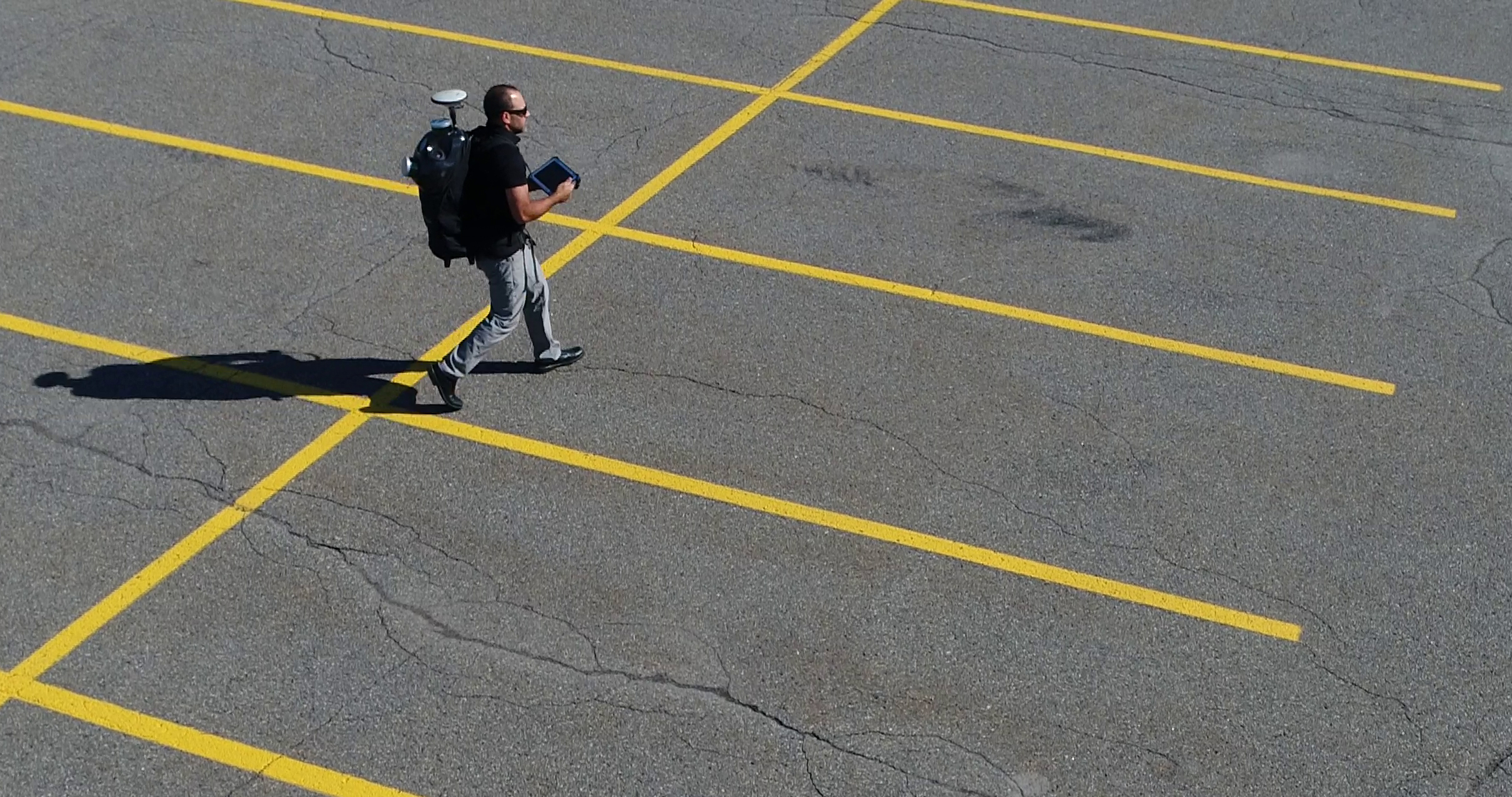
Capture immersive 3D imagery just by walking
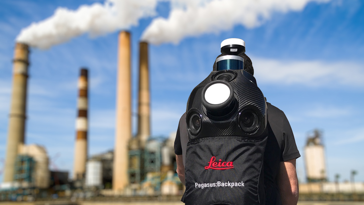
The Leica Pegasus:Backpack is the award-winning wearable reality capture solution enabling you to make quick and informed decisions in fast-changing, challenging and hostile environments. Just by walking, this multidisciplinary system allows you to digitize pedestrianized city centres, the progress of construction sites, building interiors, underground structures and many more challenging applications.
Light and robust, the Pegasus: Backpack goes wherever you do
The lightweight carbon unibody system frame and the researched ergonomic support structure increases the mobility and flexibility for the wearer under challenging conditions, and reduces fatigue resulting in increased productivity.
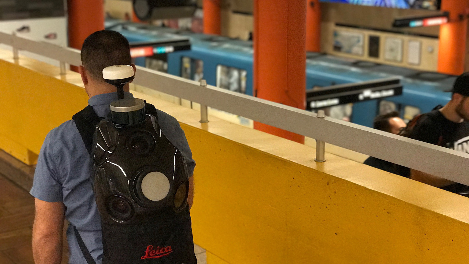
Mobile mapping - indoors, outdoors, even underground
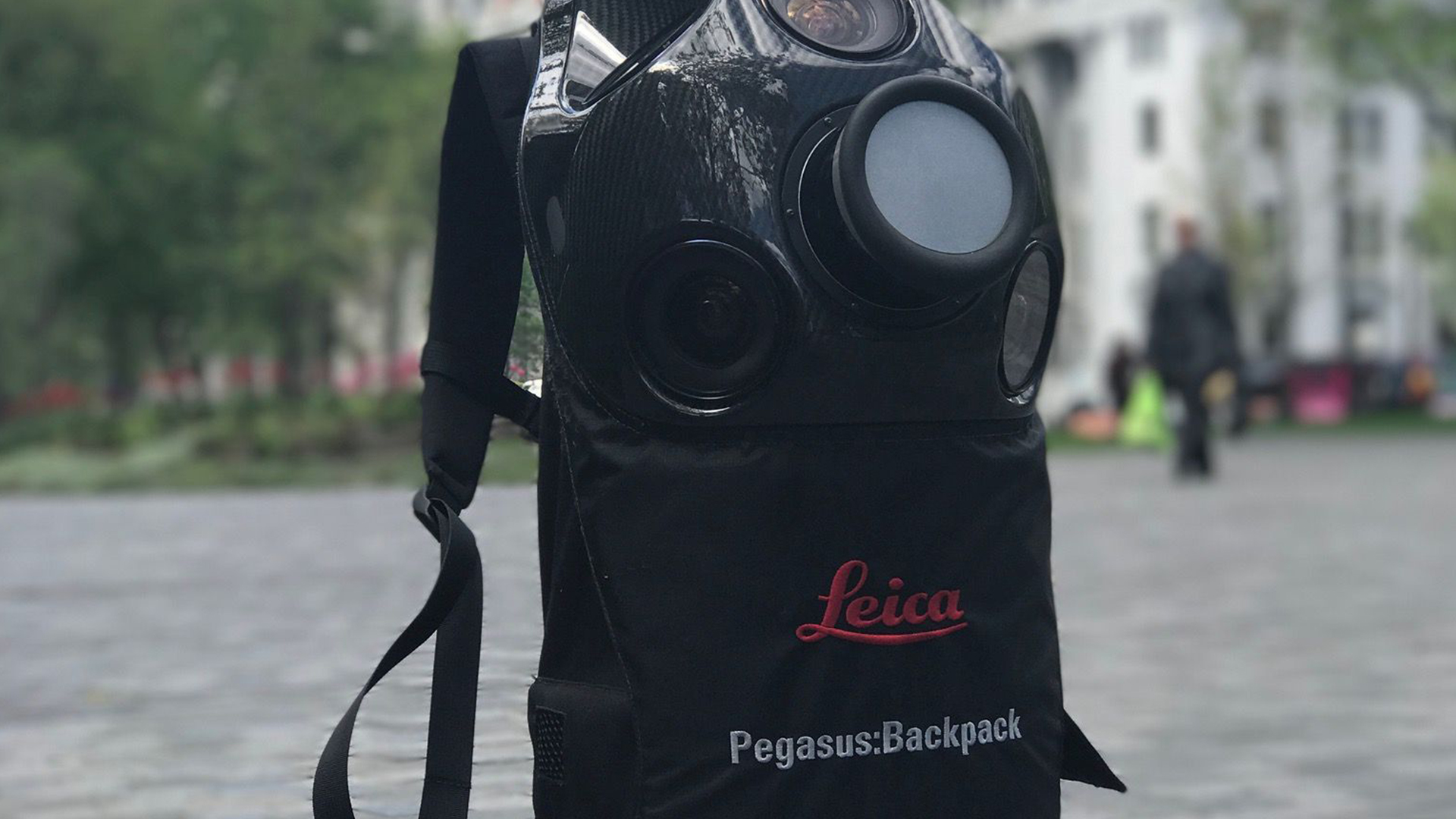
The Leica Pegasus:Backpack is an award-winning wearable reality capture sensor platform. A highly ergonomic design combines five cameras offering fully calibrated 360 degrees view and two LiDAR profilers with an ultra-light carbon fibre chassis. It enables extensive and efficient indoor or outdoor documentation at a level of accuracy that is authoritative and professional.
Meet the Tech.
Wearable Reality Capture
The Leica Pegasus:Backpack is an award-winning wearable reality capture sensor platform. A highly ergonomic design combines five cameras offering fully calibrated 360 degrees view and two LiDAR profilers with an ultra-light carbon fibre chassis. It enables extensive and efficient indoor or outdoor documentation at a level of accuracy that is authoritative and professional.
Innovative
The Pegasus:Backpack makes progressive professional BIM documentation a reality. It synchronises imagery and point cloud data, therefore assuring a complete documentation of a building for full life cycle management. By using SLAM (Simultaneous Localisation and Mapping) technology and a high precision IMU, it ensures accurate positioning with GNSS outages.
Portable
This unique mobile mapping solution is designed for rapid and regular reality capture. It is completely portable, enabling it to be checked in as luggage on a flight.

Apply your data.
Safety and Security
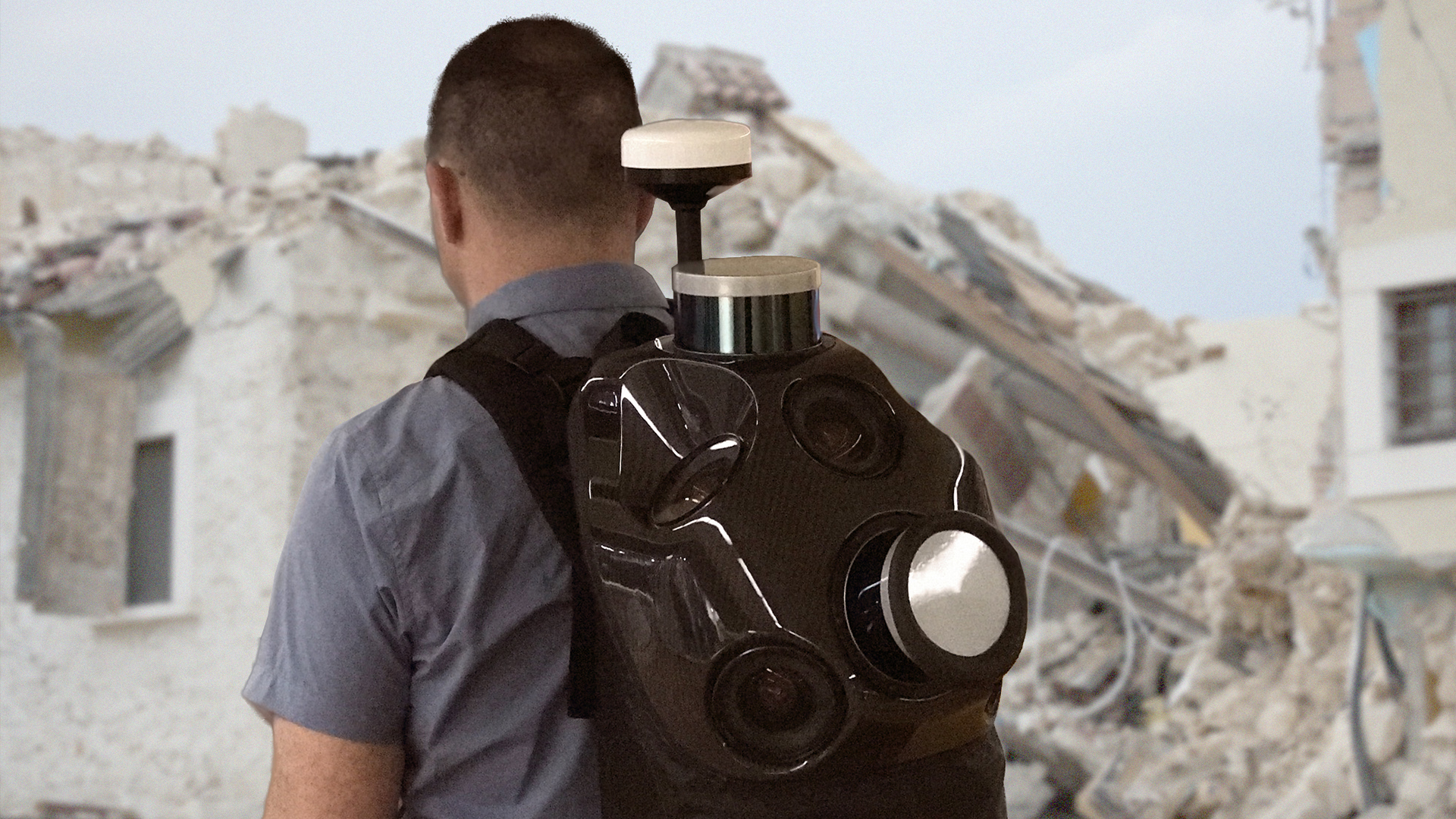
The Pegasus:Backpack helps you to make better and faster decisions in emergency situations due to access to more accurate data. Evacuation plans and route mapping benefit from clear and detailed images and point clouds that alert authorities to any changes. Access densely populated areas, providing accurate and current mapping to give city authorities a clearer and deeper understanding of the situation.
Natural disaster response
For the first time, responders to natural disasters can capture disaster area data in 3D on foot. Faster response times translate into lives saved and damage minimised. Capture the critical data needed to make faster and better informed decisions that increases chances of survival and reconstruction.
Industrial training
Knowing and understanding a landscape before rushing into emergency situations can save lives. Document any site in 3D models and images for fast, safe and efficient response. Combined with Autodesk, Intergraph and other software, reality-based industrial training is enhanced with the most accurate and current data sets.
Specifications
DESIGN & PHYSICAL
HOUSING
Carbon FibreWidth: 530 mm (20.87 in.)
Height: 950 mm (37.40 in.)
Depth: 430 mm (16.93 in.)
WEIGHT
10.3 kg11.9 kg with battery
MOUNTING
Backpack to mount on personOPERATION
CONTROL
Multi-core industrial PC, low power consumptionWIRELESS
Ethernet and wireless connections available. Service support available through remote connection.DATA STORAGE
1 TB SSD hard disk with USB3 interface.POWER
INTERNAL
4 hrs (4 Batteries), Batteries are hot-swappable (no shut down needed)SCANNING
DISTANCE MEASUREMENT
903 nm wavelengthLASER CLASS
1 (in accordance with IEC 60825-1)FIELD OF VIEW
360 ° (HORIZONTAL)30 ° (VERTICAL)
RANGE
0 m (MIN)200 m (MAX)
SPEED
600,000 pts/sec / 900,000 pts/sec (Long Range)DENSITY
Based on capture speedIMAGING
CAMERA
40 MP 5-camera system, 2 fps x camera equal to 40 M pixels per second, 360° x 200°SPEED
ContinuousTHERMAL
Optional (external)ENVIRONMENTAL
OPERATING TEMPERATURE
0 ° C (MIN)40 ° C (MAX)
IP RATING
IP52 (Dust / Dripping water protected)NAVIGATION SENSORS
GNSS
YesDATA PROCESSING
DATA TRANSFER
Ethernet and wireless connections available. Service support available through remote connection.DESKTOP SOFTWARE
Pegasus Manager
Ready to learn more?
Our EXPERTS@R-E-A-L.iT are ready to help you with onboarding this new technology in your business. Whether you need to train your employees with this new hardware, or have questions about what software solutions to use in the office to get the most out of your data, we are ready to assist you at every step of the process. Check out our coaching plans here. Still have questions? Click the button below to start a conversation with one of our experts.
Contact Us.
-

-

-

-

Our
EXPERTS@R-E-A-L.iT
are ready to help you with onboarding this new technology in your business. Whether you need to train your employees with this new hardware, or have questions about what software solutions to use in the office to get the most out of your data, we are ready to assist you at every step of the process.
Still have questions? Click the button below to start a conversation with one of our experts.